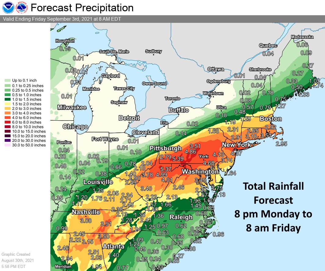
Just days after Hurricane Henri soaked portions of New Jersey and New York with more than 8″ of rain, it looks like Ida is going to do more of the same, bringing another round of extremely heavy rain to a place that doesn’t need it. Ida, once a Major category 4 Hurricane, is now just a tropical depression. However, it will bring extremely moist tropical air north and interact with and merge with a frontal boundary, setting the stage for another round of heavy rain and flash and river flooding across parts of the Tennessee & Ohio Valleys, the central Appalachians & the Mid Atlantic.
In addition to heavy rain, there is also an elevated risk of tornadoes as Ida’s remnants push through. The best chance for tornadoes on Tuesday / Tuesday night will be over the Florida Panhandle, western Georgia including the Atlanta metro region, and eastern Alabama. On Wednesday / Wednesday night, the greatest risk area includes southern New Jersey, Delaware, Maryland, eastern Virginia, and eastern North Carolina. While not everyone will see a tornado in these areas, some severe storms could spin up isolated tornadoes as atmospheric energy tied to these systems moves through the region.

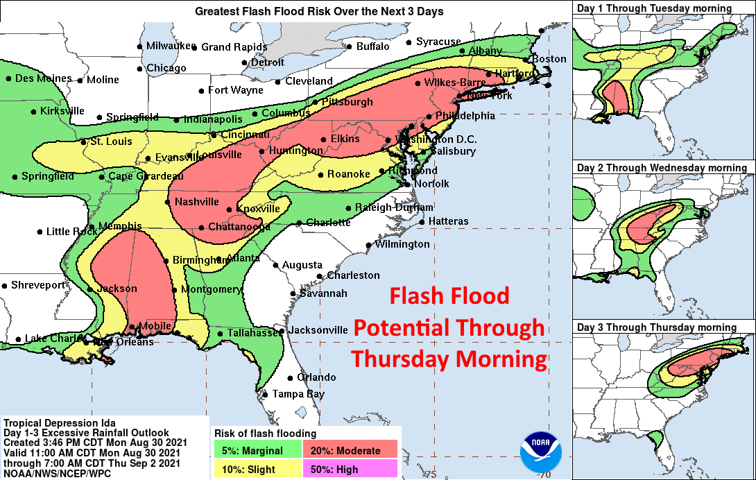
While there could be severe thunderstorms and isolated tornadoes, the big problem with Ida’s remnants will be flooding rains. 3-6″ or more of rain is possible over a relatively short time over portions of Pennsylvania, New Jersey, and New York. Combined with saturated soils and elevated rivers and streams from recent heavy rains, conditions will be ripe for river, stream, areal, and flash flooding. The heaviest rain will impact this zone between late Wednesday and Thursday.
The National Weather Service (NWS) warns: “turn around, don’t drown; never drive through flood waters.” According to the NWS, more people die from flooding than any other cause in tropical cyclones such as Ida.
