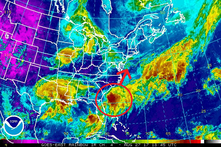
While many are in awe of the devastation Harvey is creating over Texas, Mother Nature isn’t taking a break: it appears Irma is forming off of the southeastern US coast. An elongated area of low pressure, previously located over northeast Florida, has emerged over the western Atlantic and is now located about 60 miles east of the coast of Georgia. Showers and thunderstorms associated with this system have increased in coverage and are gradually becoming better organized. The low is likely to become a tropical depression or storm during the next day or so before it merges with a cold front. Regardless of development, the low is expected to cause increasing winds and rough surf along the coasts of Georgia, the Carolinas, and Virginia through mid-week.
With the system developing, the National Hurricane Center (NHC) says a tropical storm watch may be required for a portion of the coast of North and South Carolina this afternoon.
Should the system become a named cyclone, it will be called Irma, the next name in line for the 2017 Atlantic Hurricane Basin.
Heavy rain is also expected to continue over portions of the Florida peninsula during the next 24 hours creating flooding problems there.
Residents further up the coast, including Maryland, Delaware, New Jersey, and New York should closely monitor the future progress of this storm.
Experts believe this Atlantic Hurricane Season, which runs through to the end of November, will be a busy one. Dr. Phil Klotzbach and the experts at Colorado State University updated their seasonal outlook again on July 5, showing a much more active than normal season expected. The National Oceanic and Atmospheric Administration (NOAA) also released their own forecast which shows this hurricane season to be likely more active than others.