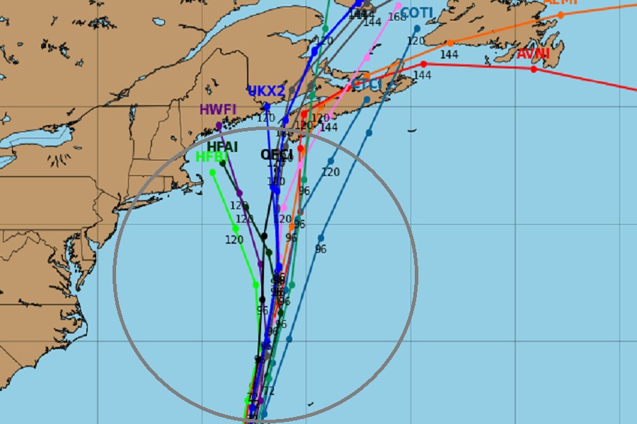
It now appears more likely than not that Hurricane Lee will make landfall along the east coast of North America next weekend; all major forecast guidance is suggesting Lee will head into the northeastern U.S. coastline or the coastline of Atlantic Canada.
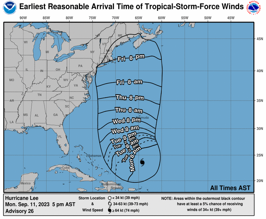
While computer model forecast guidance is offering a nearly 100% chance of a landfall, the National Hurricane Center (NHC) is much more conservative with their outlook. The NHC forecast, which only extends out 5 days into the future, isn’t as confident. “It remains too soon to know what level of additional impacts Lee might have along the Northeast U.S. coast and Atlantic Canada late this week and this weekend. However, wind and rainfall hazards will likely extend well away from the center as Lee grows in size,” the NHC said in their latest forecast discussion.
As of the last update from the NHC, Lee was located about 380 miles north of the Northern Leeward Islands and about 600 miles south of Bermuda. The storm, a category 3 hurricane on the Saffir-Simpson hurricane wind scale, had maximum sustained winds of 115 mph with a minimum central pressure of 948 mb or 28.00″.
Lee is moving toward the west-northwest near 7 mph. According to the NHC, a slow west-northwest to northwest motion is expected during the next couple of days, followed by turn toward the north by midweek. On the forecast track, Lee is expected to pass near, but to the west, of Bermuda in a few days. While Lee heads north, little change in strength is forecast over the next couple of days. However, as it moves closer to the U.S. northeast coast, colder water temperatures should help weaken the storm.
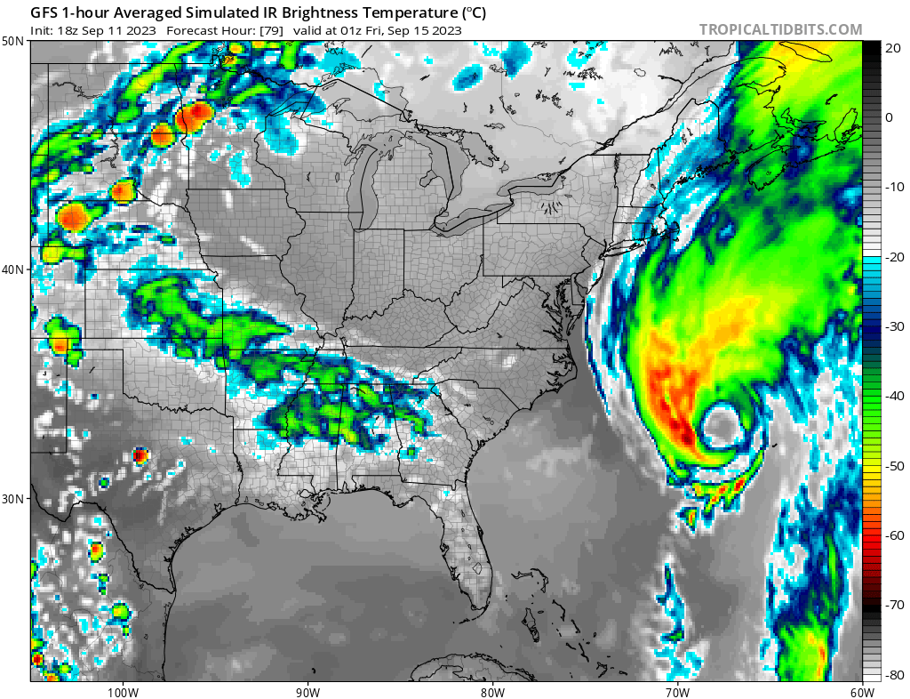
While Lee weakens as it moves north, it will expand in size and the area impacted by the storm will grow with time. Because of this, areas well away from the storm center could be impacted by strong winds, heavy rain, rough surf, and coastal beach erosion.
Swells generated by Lee are affecting portions of the Lesser Antilles, the British and U.S. Virgin Islands, Puerto Rico, Hispaniola, the Turks and Caicos Islands, the Bahamas, and Bermuda. These swells are likely to cause life-threatening surf and rip current conditions. Dangerous surf and rip currents have begun to affect portions of the southeastern U.S. coast, and these conditions are forecast to spread northward along much of the U.S. East Coast during the next day or two. Rough surf will remain for days after the storms passage too; even expert swimmers and surfers should avoid the ocean until all threats from Lee pass.
Over the coming days as more data is understood by meteorologists and the forecasting tools they use, the future track of Lee will be refined and better known. For now, people throughout the entire northeastern U.S. as well as Atlantic Canada should have their Hurricane Action Plan in order. It may become necessary to act on it in the coming days.
