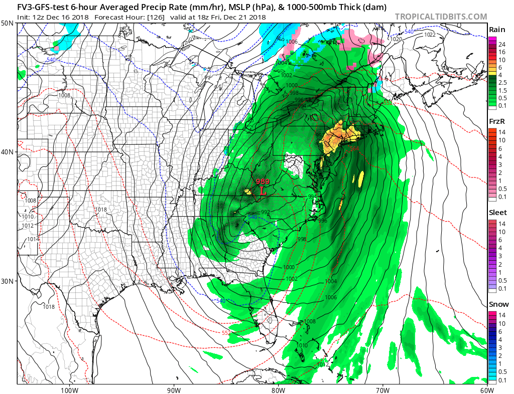
While records continue to fall with the most precipitation measured in a year throughout the East, it looks like yet another storm will bring more heavy rain to the region. This next storm system is expected to unfold later Wednesday, producing soaking rains east of the Mississippi River on Thursday, Friday, and Saturday.
By early Thursday, a high amplitude upper trough will be digging south across the southeastern U.S. and Gulf of Mexico. A large, strong area of low pressure is expected to develop across the southeastern U.S. on Thursday bringing rain showers into the Mid Atlantic. Rain will eventually slide into New England by Thursday night. With mild air in place, the only risk of non-liquid precipitation is over northern New Hampshire and northwestern Maine. But even there, most precipitation will fall as rain. A new low will movie up the Appalachians and the Ohio River Valley to our west during the Friday/Saturday timeframe. Global forecast guidance from computers that meteorologists use to aid in their forecasting continue to forecast the development of a well-defined synoptic trough over the eastern U.S. by Thursday. Several factors including broad mid to upper-level diffluent flow, appreciable positive vorticity advection, and a jet streak located over the Northeastern U.S. and Canadian Maritimes all support the development of a strong extratropical cyclone. With mild air racing up the coastal plain, Friday will likely feel more like Spring than a few days before Christmas in places like Philadelphia, New York, and Boston. But the mild-spring like temperatures will be short-lived; cooler air will wrap around behind the system as the surface low pulls to the northeast on Saturday.
After a brief lull, additional precipitation is expected to wrap around the surface low Saturday and early Sunday in the northeast. As cold air advects into the region, some of this could fall in the form of snow showers as far south as the Lehigh Valley and the Poconos in Pennsylvania and the mountains of northwestern New Jersey. Dry weather will return to the East by Sunday or Sunday night, setting the stage for a fair and uneventful Christmas Eve and Christmas morning, weather-wise.
Before the Christmas calm, though, conditions will be wet and windy. Very heavy rain and the threat of embedded thunderstorms will be possible from Florida north to Maine. This storm will dump another 2-4″ of rain, with the heaviest expected over eastern Pennsylvania and Maryland, Delaware, the New York City metro area, Connecticut, Rhode Island, and Massachusetts. Heavy rain will also be joined by strong winds, especially at coastal locations. Those with outdoor holiday decorations should make sure they are properly secured prior to the arrival of this storm.