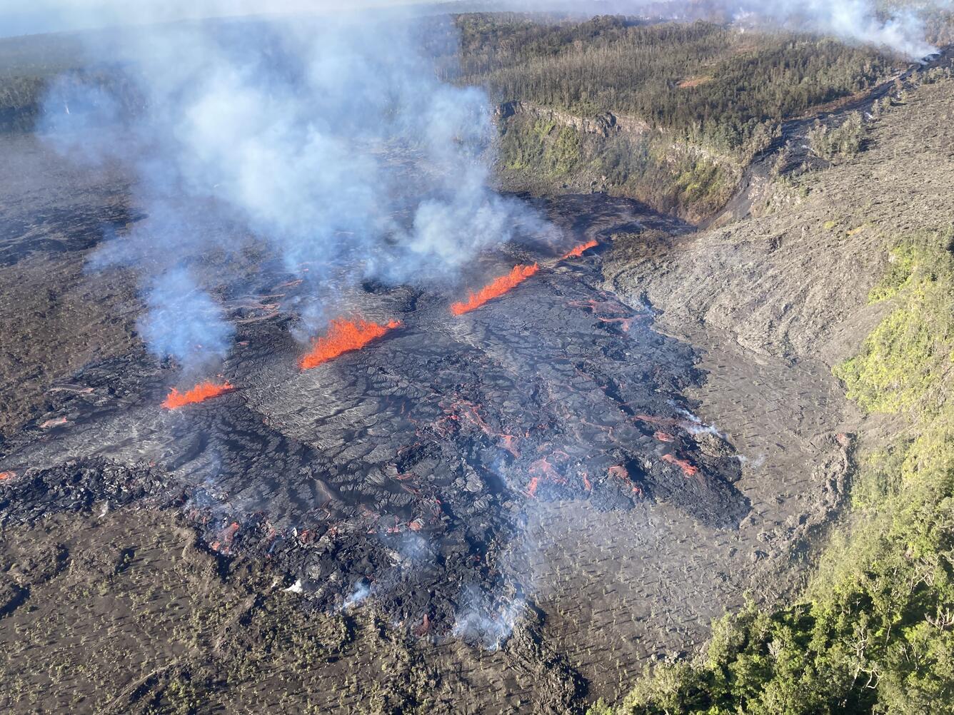
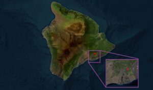
Lava continues to erupt from growing cracks on the Big Island of Hawaii. Over the weekend, USGS and the Hawaiian Volcano Observatory (HVO) upgraded the volcano alert level for Kilauea located on the Big Island’s eastern side. Since then, three eruption events have been confirmed with the third ongoing now.
“The eruption is occurring within a closed and remote area of Hawaii Volcanoes National Park”, USGS said in an updated statement released today. “There is no immediate threat to life or infrastructure. Chain of Craters Road, which is closed, is located far downslope and downwind of the eruption. Residents of nearby subdivisions may experience volcanic gas emissions related to this activity which may increase and decrease over the coming hours and days.”
USGS scientists with the Hawaiian Volcano Observatory (HVO) decided to elevate the alert / code level at Kilauea Volcano on Hawaii’s Big Island to ORANGE / WATCH and have kept the alert at that level since.
HVO is responsible for issuing Aviation Codes and Volcanic Activity Alert Levels. Aviation Codes are green, yellow, orange, or red. When ground-based instrumentation is insufficient to establish that a volcano is at a typical background level of activity, it is simply “unassigned.” While green means typical activity associated with a non-eruptive state, yellow means a volcano is exhibiting signs of elevated unrest above known background levels. When a volcano exhibits heightened or escalating unrest with the increased potential of eruption, it jumps to orange. Finally, when an eruption is imminent with significant emission of volcanic ash expected in the atmosphere or an eruption is underway with significant emission of volcanic ash into the atmosphere, the code becomes red. Volcanic Activity Alert levels are normal, advisory, watch, or warning. As with aviation codes, if data is insufficient, it is simply labeled as “unassigned.” When the volcano is at typical background activity in a non-eruptive state, it is considered normal. If the volcano exhibits signs of elevated unrest above background level, an advisory is issued. If a volcano exhibits heightened or escalating unrest, a watch is issued while a warning is issued when a hazardous eruption is imminent.
Numerous eruptions took place in Kilauea’s middle East Rift Zone during the 1960s–1970s. Most of these eruptions occurred between Hiʻiaka crater and Puʻuʻōʻō and lasted from less than one day to about two weeks, although there were long-lived eruptions at Maunaulu (1969–1971 and 1972–1974) and Puʻuʻōʻō (1983–2018).
In the area of today’s ongoing eruption, USGS says there were more than 20 eruptions in this area between 1848 and 1869 and additional episodes in 1965, 1968, and 1997.
According to HVO, there have been approximately 17 earthquakes detected beneath the Kilauea summit region over the past 24 hours, at depths of 0.6–1.9 miles below the ground surface, and with magnitudes of 2 or less. Summit tiltmeters continued recording deflationary tilt throughout the day yesterday. USGS says this pattern is consistent with magma leaving the summit storage chambers and transferring to the middle East Rift Zone. Because the tiltmeters haven’t changed much and because seismic activity continues, it is assumed the eruption will continue for now, fueled in part by magma being transported to the area of fissures at the eruption site.
USGS has set-up a webcam view of the eruption site so viewers can watch the eruption safely from home. The link is: https://www.usgs.gov/observatories/hvo/s2cam-view-napau-crater-east-rift-zone-kilauea-view-southwest .
