A potent storm system moving across the eastern United States today will bring about conditions more associated with early spring than the end of January for much of the East Coast. Strong to severe thunderstorms in the southeast, heavy rain in the Mid Atlantic and coastal New England, and interior wet snow are all expected today as the system moves through. A surface low in southern Quebec will lift northeast today, and a cold front extending to its south will move through the Mid-Atlantic and offshore by this evening. This low and its associated fronts is what’s driving today’s weather in from Maine to Florida.
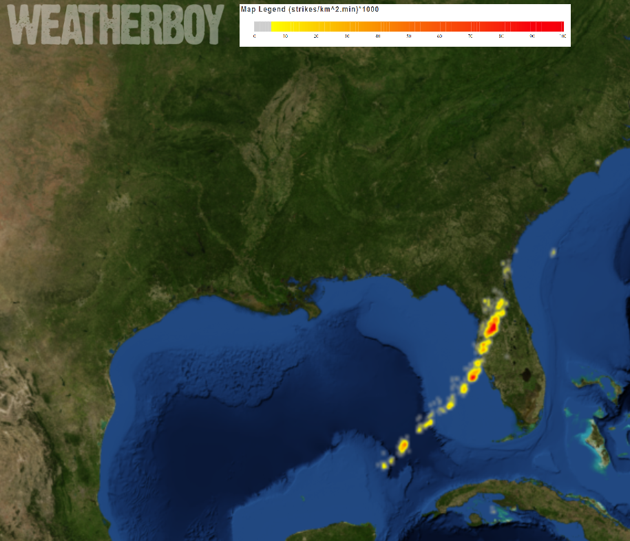
This morning, strong to severe thunderstorms are moving through Florida. A lightning density map from weatherboy.com shows a high density of storms moving through central and western Florida. As the day progresses, the line of thunderstorms will stretch north up the East Coast, with strong to severe storms also possible along eastern North Carolina. While the atmosphere doesn’t support much thunderstorm activity north of North Carolina, a rumble of thunder here and there can’t be ruled out even in coastal New England.
While thunderstorms won’t be common, heavy rain will be across much of the Mid Atlantic into eastern New England. 1-2.25″ of rain is expected to fall today, with the heaviest amounts expected over Delaware, eastern Pennsylvania, New Jersey, and southeastern New York including New York City and Long Island. Flooding is possible in this area, prompting the National Weather Service to issue flood-related advisories for many counties in the northeast. To the north, rain will also fall in eastern New England where snow fell last weekend. As rain melts snowpack and/or falls on frozen surfaces, the additional runoff could be stressful to area creeks, streams, and rivers, possibly creating flood conditions there too. Ice jam flooding is also a possibility as this run-off hits frozen or partially frozen waterways.
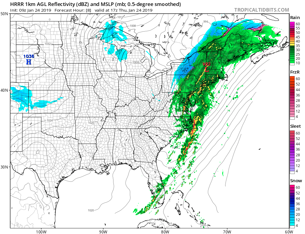
Some potent lines of heavier rain showers are forecast to form this afternoon, bringing sudden downpours to localized areas for a short period of time. These heavier pulses of rain may trigger flash flooding where they move through. Some strong, potentially damaging winds can also be mixed down to the surface in these heavy rain bands, especially near the coast. For this reason, the National Weather Service has also issued wind advisories for some to alert of the possibility of damaging wind gusts.
Another low in the Great Lakes tonight will move into southeast Canada, allowing a reinforcing cold front to move through the northeast on Friday. This frontal passage will push today’s system out of the area and allow high pressure to build into the eastern U.S. this weekend. Another cold front moves through the region Sunday night and Monday, but may return as a warm front on Tuesday. Another surface low will move from the Great Lakes to the Northeast by the middle of next week, with an attendant cold-frontal passage anticipated for the Mid-Atlantic. Even as these systems pass through, it is unlikely that the weather pattern will support prolonged real wintry weather and blockbuster snowstorms around the I-95 corridor in the near future.
