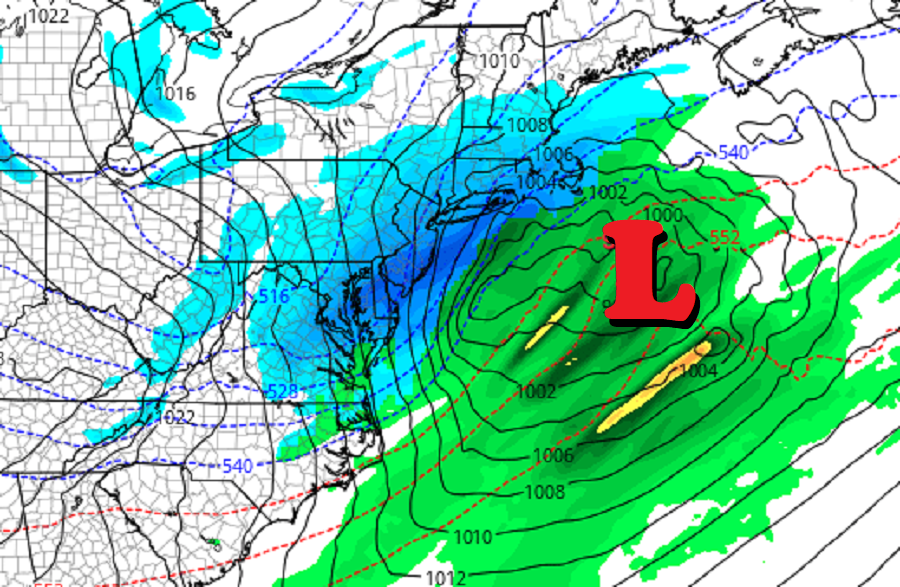
Just days after a winter storm blanketed portions of the Mid Atlantic with more than 10″ of snow, a new storm is likely Thursday and Friday over a larger area in the Mid Atlantic and New England regions.
Before the “main event” arrives on Thursday and Friday though, a weather disturbance moving through the Mid Atlantic could create an icy mess on Wednesday. According to the National Weather Service, an amplifying trough from the Midwest to the Great Lakes will increase the warm air advection across portions of Pennsylvania, New Jersey, Delaware, Virginia, and Maryland. This will be enhanced some as a southwesterly low-level jet arrives. In response to this, clouds will increase and thicken towards daybreak Wednesday. The combination of strengthening low-level warm air advection, the arrival of a southwesterly low-level jet and a weak disturbance could develop some light precipitation closer to daybreak Wednesday. With the ground at or below freezing, especially in areas with fresh snow cover, any light rain or drizzle that forms could freeze on contact.

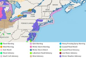
Due to the threat of freezing rain/drizzle, the National Weather Service has issued Winter Weather Advisories for Wednesday for portions of southern upstate New York, most of New Jersey, eastern Pennsylvania, all of Delaware, much of eastern Maryland, and portions of eastern Virginia.
A trailing frontal boundary associated with Wednesday`s system will be stalled near the coast for Thursday; this will extend south and west to a new area of low pressure forecast to develop near the Gulf Coast. Later on Thursday, this system will move east, spreading precipitation across the southern Appalachians and Ohio River Valley. By Thursday evening, snow should break out over much of Tennessee, Kentucky, and West Virginia.
By Friday morning this storm system will reach the coast and rapidly intensify, sending a broader precipitation shield up the east coast. Around breakfast time on Friday, snow should spread from West Virginia and Virginia through Delaware, New Jersey, Pennsylvania, and much of southeastern New England. The snow could become heavy at times Friday morning, with the heaviest snowfall possible over portions of eastern Maryland, Delaware, New Jersey, southeastern New York, Connecticut, Rhode Island, and southeastern Massachusetts.
Such a storm path should generate a widespread area of 4-8″ or more of snow. At this time, it appears the heaviest snow will be along or just south of the I-95 corridor stretching from Washington, DC through Baltimore, Philadelphia, and New York to Boston. If the storm tracks a bit further south and east, snow amounts would decrease on the northern and western sides of this storm; if the storm tracks a bit further north and west, sleet, freezing rain, and even plain rain could move into portions of the coastal plain and keep snow totals lower there.
Meteorologists should have a better idea of the forecast storm track as new data is processed during the day on Wednesday ahead of the main event on Friday.
While snowfall amounts remain in question, it looks like strong, cold winds behind the system will be a sure-bet. Strong northwest winds gusting 20-30 mph are forecast to follow in the storms wake later Friday into early Saturday, putting the northeast into a deep freeze. Extended guidance suggests that even colder temperatures will arrive during the early part of next week, making January feel very much like a typical wintertime period.