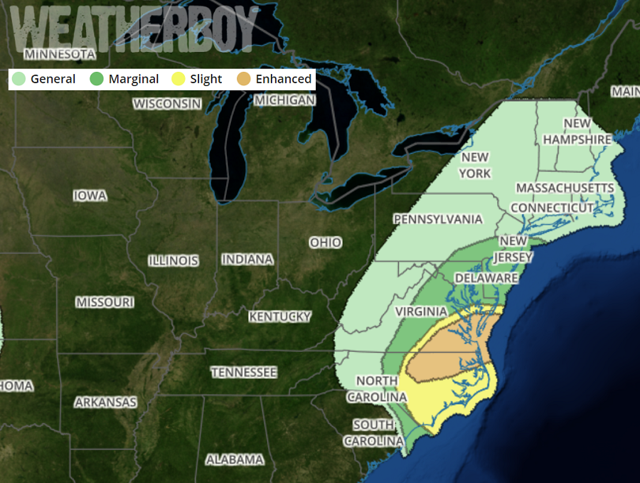
A day after becoming the third most intense hurricane to ever strike the United States coastline, Michael continues to march up the East Coast as a Tropical Storm, bringing flooding rains, damaging winds, and the threat of tornadoes with it.A Tornado Watch has been issued for portions of the East Coast while Storm Surge Watches and Tropical Storm Warnings remain in effect. A Tornado Watch is issued when severe thunderstorms are expected to form, bringing damaging winds, large hail, and isolated tornadoes with them. The Storm Storm Surge Watch, which is in effect along the North Carolina Coast from Ocracoke Inlet Duck, is issued when there is a possibility of life-threatening inundation from rising water moving inland from the coastline. A Tropical Storm Warning is in effect from the Savannah River to Duck, North Carolina; it includes the Pamlico and Albermarle Sounds. A Tropical Storm Warning means that tropical storm conditions are expected somewhere within the warning area.
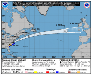
As of the latest update from the National Hurricane Center, Tropical Storm Michael was centered near latitude 34.7 North, longitude 80.8 West. Michael is moving toward the northeast near 23 mph and this motion is expected to continue with an increase in forward speed through tonight. A turn toward the east-northeast at an even faster forward speed are expected on Friday and Saturday. On the forecast track from the National Hurricane Center, the center of Michael will continue to move across central and eastern North Carolina today, move across southeastern Virginia this evening, and move into the western Atlantic Ocean tonight. It will continue to accelerate across the Atlantic Ocean this weekend, arriving in France or England in Europe by Monday. Maximum sustained winds are near 50 mph with higher gusts. While Michael’s days as a hurricane is over and little change in strength is expected today, Michael is forecast to intensify as it becomes a post-tropical low over the Atlantic late tonight.
While the impacts from Michael are wide, the impacts from its winds are over a smaller area. Right now, tropical-storm-force winds extend outward up to 185 miles mainly to the south and east of the center. A wind gust of 54 mph was recently reported at Folly Island, South Carolina. Myrtle Beach, South Carolina, recently reported a wind gust of 47 mph. Based on surface observations, the estimated minimum central pressure of Tropical Storm Michael is 990mb or 29.23″.
Threats from wind, storm surge, flooding rains, and tornadoes exist today into early tomorrow as Tropical Storm Michael moves north and east up the Mid Atlantic coast.
While Michael had destructive sustained winds over 155mph yesterday at landfall, winds are much more relaxed now. However, tropical storm force winds can still do damage. Tropical storm conditions are occurring over portions of central and eastern South Carolina now and will spread northward over central and eastern North Carolina this afternoon and evening. Gale- to storm-force winds are expected over portions of southeastern Virginia, extreme northeastern North Carolina, and the DelMarVa Peninsula late tonight and Friday morning when Michael becomes post-tropical off the Mid-Atlantic coast.
The circulation around Michael will continue to impact coastal waters and create storm surges for some. The combination of a dangerous storm surge and the tide will cause normally dry areas near the coast to be flooded by rising waters moving inland from the shoreline. The water has the potential to reach 2-4 feet above ground on the Sound side of the North Carolina Outer Banks from Ocracoke Inlet to Duck if peak surge occurs at the time of high tide.
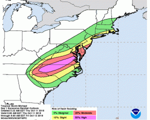
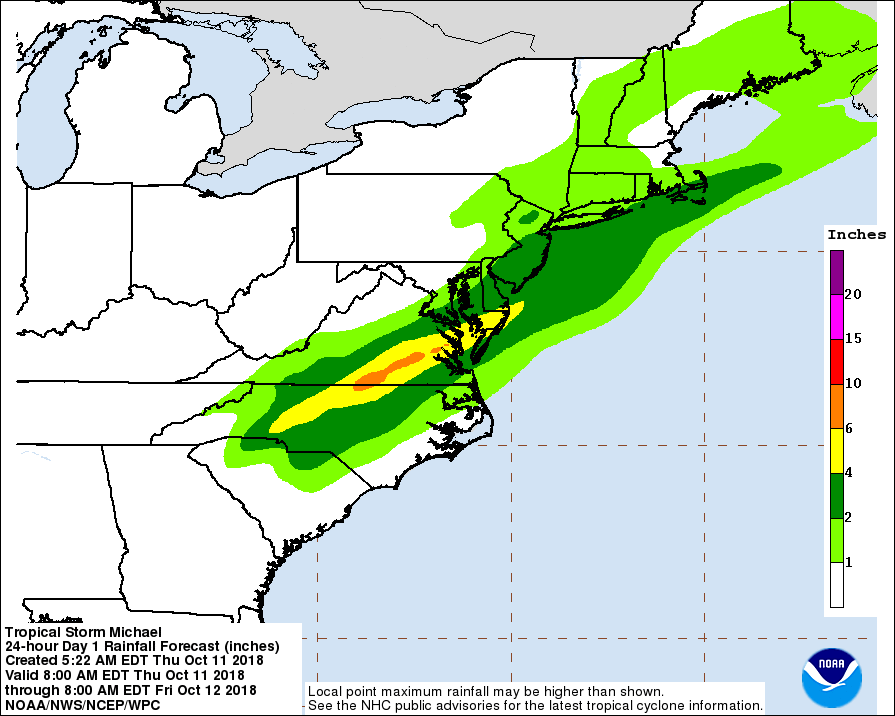
Heavy rain will continue to fall from Michael, possible producing life-threatening flash floods. Michael is expected to produce total rain accumulations of 4 to 7 inches from northern South Carolina, west-central to northwestern North Carolina, and into south-central to southeast Virginia, including the southern Delmarva Peninsula. Isolated maximum ttals of 9 inches are possible in North Carolina and Virginia. Rainfall totals of 1 to 3 inches are expected across the Central Appalachians into the Mid-Atlantic and southern New England.
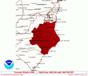
The rotation created in the atmosphere by Michael’s swirling winds could spawn isolated tornadoes. Tornadoes are possible through this evening across central and eastern North Carolina and southeast Virginia. Because of this threat, the National Weather Service has issued a Tornado Watch for portions of the Mid Atlantic. Showers arcing across southern into central North Carolina should intensify and develop into embedded thunderstorms as they spread northeast in association with Michael. Low-level shear and pockets of downstream surface heating will be favorable for at least a few tornadoes, mainly this afternoon into early evening. The tornado watch area is approximately along and 95 statute miles east and west of a line from 20 miles south of Jacksonville, North Carolina to 35 miles north northwest of Richmond, Virginia.