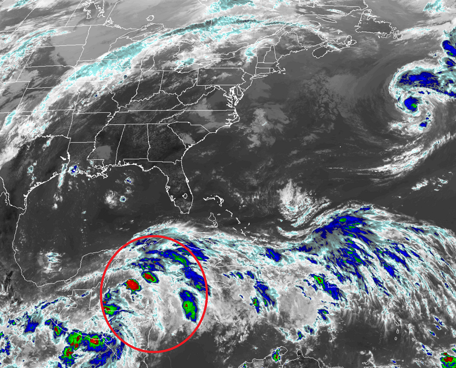
All eyes will be on the Gulf of Mexico in the coming days; it is becoming more and more likely a tropical cyclone that’ll eventually be named Michael will head that way. Whether or not a named storm forms, heavy potentially flooding rains are likely to impact portions of the Yucatan and the U.S. Gulf Coast. Heavy rains could also make their way to the southeastern U.S. which was hard hit by Hurricane Florence flooding recently.
Satellite imagery, surface observations, and radar data from Belize indicate that the area of concern is an area of low pressure is centered just north of the Bay Islands of Honduras. The associated showers and thunderstorms show signs of organization, however, the system does not yet have a well-defined circulation. According to the National Hurricane Center, environmental conditions are expected to become gradually more conducive for further development, and a tropical depression or tropical storm is expected to form over the northwestern Caribbean Sea or the southern Gulf of Mexico on Sunday or Monday while the system moves slowly northward.
The next name to be used by the National Hurricane Center for a tropical storm in the Atlantic Basin is Michael.
The National Hurricane Center encourages interests in the Yucatan peninsula, western Cuba, and the northern coast of the Gulf of Mexico to monitor the progress of this system during the next several days. Regardless of tropical cyclone formation, this disturbance will continue to bring torrential rains to portions of Central America, the Yucatan peninsula, and western Cuba into next week. By the end of next week, more direct impacts could be felt in the United States.