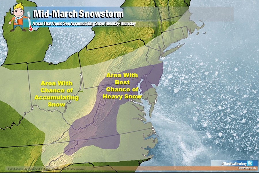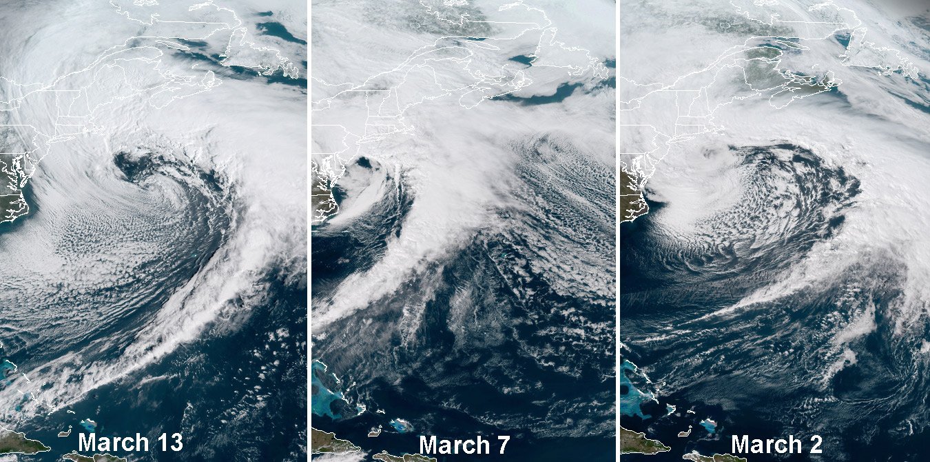
For the fourth time in about two weeks, another major winter storm will be impacting the US East Coast. This time, Old Man Winter appears to have the Mid Atlantic in the target zone. The blocking weather system over the western Atlantic which helped steer storms up the New England coast recently is “backing-up” closer to the US; as a result, this storm now appears to be blocked from running up the coast and will instead primarily impact the Mid Atlantic.

Image: RAMMB/CIRA
During the computer forecast guidance runs this afternoon and overnight last night, it appears the storm will evolve into a more progressive solution that would favor a suppressed storm track for the Monday night/Tuesday system and for the second Wednesday/Wednesday night wave. The National Weather Service office in Mount Holly, NJ, says in their latest forecast discussion, “If these trends were to hold up, the extent, duration and severity of impacts would be much lower than what models were indicating 1-2 days ago. Given this storm is still 3-5 days out and the predictability skill for such a complex setup with a parade of disturbances in play along with the potential for phasing to occur is limited, it’s a bit premature to rule out a shift back in the other direction that would put us back in play for a long duration, higher-impact event from late Monday night through Wednesday night.” The forecast office adds, “The bottom line is the poor run-to-run continuity and lingering spread among the operational models and the individual ensemble forecast systems hinders our ability to provide specific details with high certainty, on things such as rain and snow accumulations, where the rain/snow line sets up and how it evolves over time, and the magnitude of winds/beach erosion/coastal flooding.
While questions remain in the forecast and doubts exist with forecast guidance, there is concern that the area is extra-vulnerable to storm damage and the National Weather Service wants this to remain a highly visible forecast. “A huge motivating factor for cautiously maintaining our message for a potentially high-impact event is the vulnerability of our infrastructure following the recent nor’easters this month: Trees have been weakened/damaged,
restoration efforts are still ongoing, and soils are still very saturated. This all makes our region more susceptible than usual to another round of power outages and flooding IF a worst-case scenario would come to fruition…so we don`t want to let our guard down too soon.”

Assuming the storm systems are suppressed south of the blocking system, it would bring the best chance for heavy accumulating snow to western Virginia, eastern West Virginia, north west and north central North Carolina, much of Maryland, northern Delaware, southeastern Pennsylvania, and southern New Jersey.
After this robust and complex storm exits the coast by Thursday, high pressure will finally return. Conditions on Thursday and Friday should be cold with temperatures 5-10 degrees below normal. While cold, it will be fair and dry with no additional snow or rain expected for the end of the week.