• Skip to primary navigation
  • Skip to main content
  • Skip to primary sidebar

Weatherboy

Weatherboy Weather News, Maps, RADAR, Satellite, and Forecasts.

  • Local
  • Earth Science News
  • RADAR
  • Current Warnings
  • Satellite
  • Current Maps
  • Forecast Maps
  • Video

Mid-March Severe Weather Event Unfolds

by Weatherboy Team Meteorologist - March 12, 2020

There's a heightened risk of severe weather in portions of the country today. Image: weatherboy.com
There’s a heightened risk of severe weather in portions of the country today as the latest SPC Convective Outlook map shows. Image: weatherboy.com


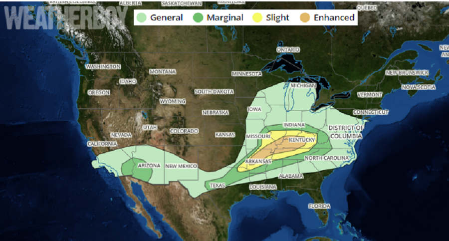
Severe storms capable of tornadoes, damaging winds and large hail, will be possible today from central Arkansas eastward into parts of southeast Missouri, southern Illinois, northern Tennessee, and much of Kentucky.

A fast moving low-amplitude shortwave trough over Kansas is moving east into the mid-Mississippi Valley this evening. At the surface, an area of low pressure will move across Missouri while a warm front becomes better established across portions of southern Illinois and Kentucky. This boundary area will make conditions ripe for severe thunderstorm formation.


Today's weather is prompting a variety of watches and warnings to be issued by the National Weather Service.  Image: weatherboy.com
Today’s weather is prompting a variety of watches and warnings to be issued by the National Weather Service. Image: weatherboy.com

Beyond storms around the warm front, thunderstorms are expected to develop along a trailing cold front now from southeast Missouri into much of Arkansas. These storms will take on supercell characteristics, possibly producing large hail and tornadoes as they do. Storms will remain active for several hours into this evening. Over time, they should weaken as they track into western Tennessee.

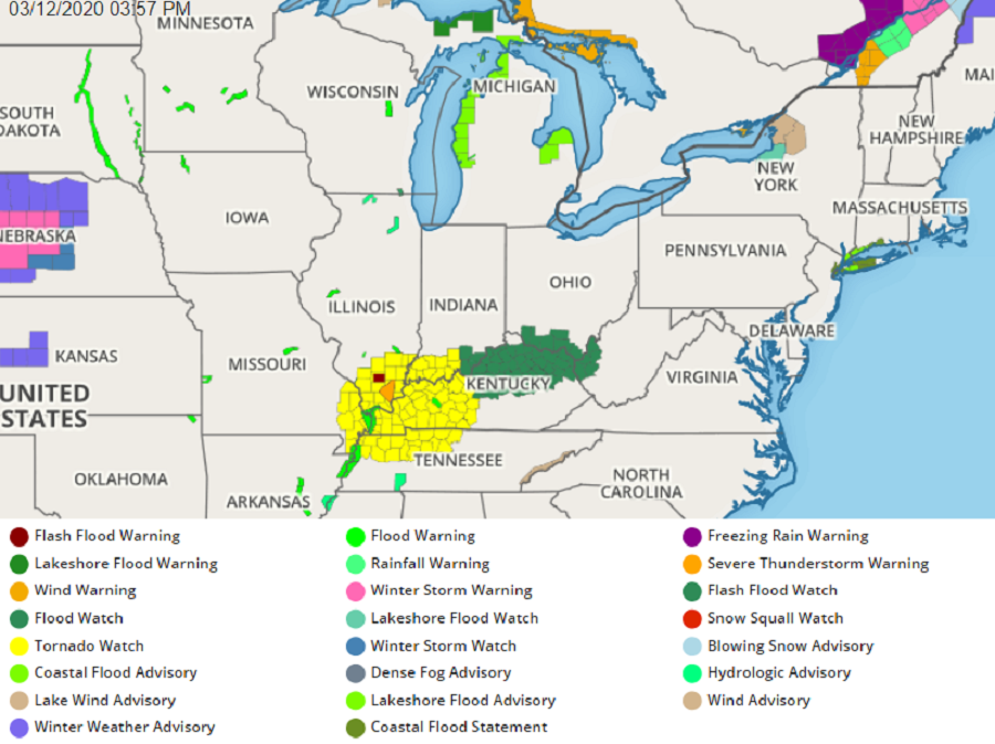
Due to the threat of severe weather, the National Weather Service has been issuing Tornado and Severe Thunderstorm Watches and Warnings today.

Some thunderstorms may also drop copious amounts of rain, creating flash flood conditions as they do so. The National Weather Service warns, “turn around, don’t drown; never drive through flooded roadways.”

Primary Sidebar

Sponsored Ad

Search

Latest News

  • Forecast Models Suggest Significant Snowstorm for New Jersey & Southeastern New England
  • Weak Earthquake Rattles Maine on Monday
  • Tenth Earthquake in 30 Days Strikes South Carolina
  • Earthquake Rattles Northern New York Sunday Evening
  • Compact Storm to Bring Snow to Pennsylvania, New Jersey, New York
  • Severe Turbulence Alert Issued for New Jersey, Pennsylvania, Delaware, & Maryland
  • Another Quake Rattles Area Outside of Charleston, South Carolina
  • After Unprecedented Airspace Shut-Down, GPS Scrambling Continues
About | Careers | Contact | Contests
Terms | Privacy | Ad Choices
Weatherboy is a (R) Registered Trademark of isarithm LLC, All Rights Reserved.
All content herein is Copyright by Isarithm LLC 1997-2022

Insert/edit link

Enter the destination URL

Or link to existing content

    No search term specified. Showing recent items. Search or use up and down arrow keys to select an item.