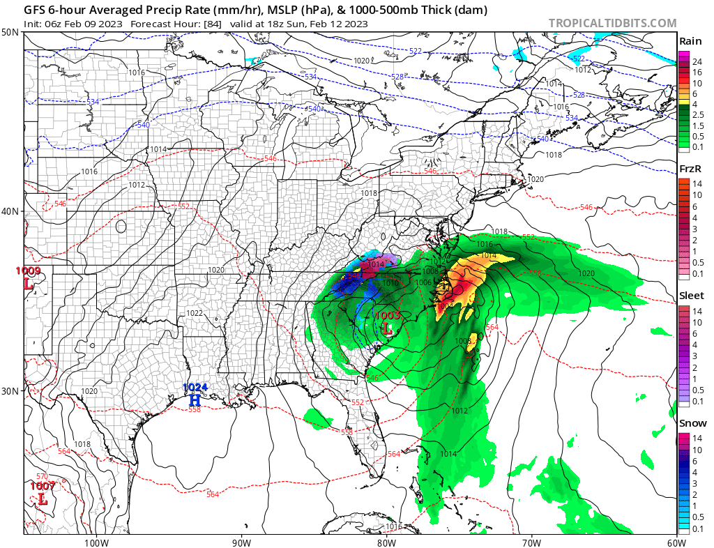
Computer forecast models used by meteorologists to aid in their forecasting of weather are suggesting the possibility that a coastal storm or nor’easter will form –a relative rarity in a lackluster snow season that has been breaking records for how little snow has fallen so far in the Northeast and Mid Atlantic. However, snow fans shouldn’t bring out the snow shovels yet: while the models are suggesting the presence of a coastal storm, it appears most precipitation will fall simply as plain rain.
The GFS and ECMWF are among many computer models meteorologists use to assist in weather forecasting. While meteorologists have many tools at their disposal to create weather forecasts, two primary global forecast models they do use are the ECMWF from Europe and the GFS from the United States. While the models share a lot of the same initial data, they differ with how they digest that data and compute possible outcomes. One is better than the other in some scenarios, while the opposite is true in others. No model is “right” all the time. Beyond the ECMWF and GFS models, there are numerous other models from other countries, other academic institutions, and private industry that are also considered when making a forecast.
For now, both of these global computer forecast models do show a coastal storm forming, but there are some subtle differences with where they form, how they intensify, and where they go. In addition to differences between the American and European models, there have also been run-to-run inconsistencies that do not lend themselves to a high confidence forecast.
Right now, it appears the system will develop across the Mid Atlantic and head more east than north, sending most precipitation and energy out to sea. And based on its trajectory, it is unlikely to be able to tap into much cold air from Canada. As a result, most precipitation associated with this storm will fall as plain rain, especially in the I-95 corridor between Washington, DC and New York City, NY.