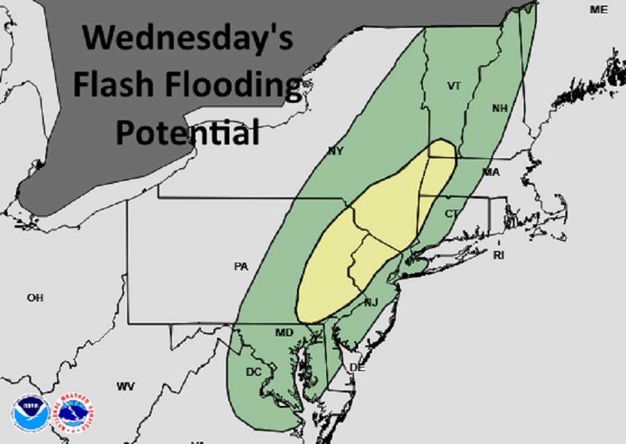
After drowning in epic flooding rains from what was left of Hurricane Ida last week, another round of heavy rain is expected across portions of the northeast tomorrow, prompting the National Weather Service to issue a new round of Flash Flood Watches. In addition to a threat of heavy rain, there’s also a threat of tornadoes, with the greatest threat in eastern Pennsylvania and southeastern Upstate New York.
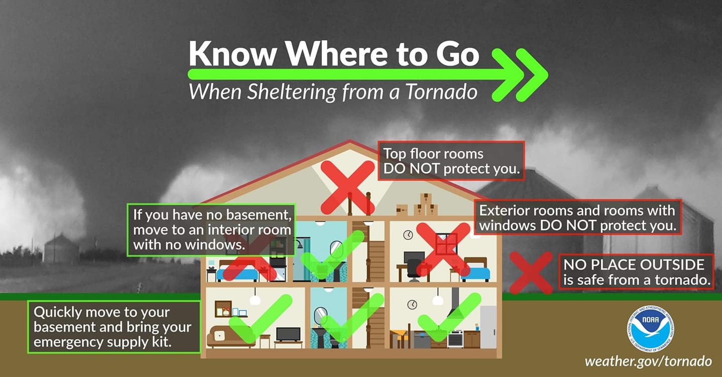
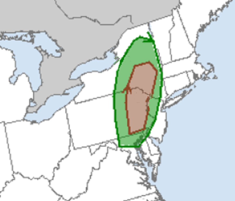
A potent mid-level trough will dig down from the Great Lakes into the Ohio Valley overnight tonight while at the surface, strong low pressure will remain centered between the Great Lakes and Hudson Bay. Tomorrow morning, a cold front will quickly advance toward the Appalachians by daybreak. The main mid-level trough axis will continue pushing toward the Mid-Atlantic region throughout the day Wednesday. This will push a cold front across the Appalachians in the morning which will eventually reach central Pennsylvania by late afternoon and into the evening. As the surface front approaches, the pressure gradient will tighten, especially into the afternoon resulting in modest warm air and dewpoint advection along and east of the frontal zone. Southerly winds will become a bit breezy with gusts of 25-30 mph possible. An environment favorable for severe storm development will blossom late tomorrow and tomorrow night; shear and kinematic values will be supportive of organized convection and rotating updrafts which could produce tornadoes.
Severe thunderstorms may also contain damaging wind gusts and large hail. Thunderstorms will also contain frequent lightning; the National Weather Service warns: “when thunder roars, head indoors.”
With humid, moisture-rich air moving north and east, the atmosphere will contain a significant amount of precipitable water that could easy rain-out 1-2″ in a short period of time. Any strong thunderstorms that form could yield high or even higher amounts. With the ground still wet from the past flooding from the remnants of Hurricanes Henri and Ida, any rain, especially heavy rain, could trigger flood conditions. While not everyone will flood, with widespread 1/2″-1″ rainfall expected, the areas that could see 1-2″ of rain could see flood conditions, especially if heavy rain falls over a short period of time.
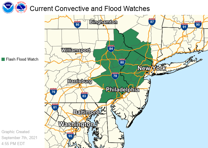
Due to the threat of flooding rains, the National Weather Service has issued a Flash Flood Watch for portions of central and northern New Jersey, eastern Pennsylvania, and southeastern Upstate New York. Included in the flood watch area is the city of Philadelphia, which continues to recover from incredible floods from the remnants of Hurricane Ida.
