The San Francisco Bay area National Weather Service office is warning that an inbound weather phenomena known as a “Pineapple Express” could bring about many dangers and hazards to California this week.
“To put it simply, this will likely be one of the most impactful systems on a widespread scale that this meteorologist has seen in a long while,” wrote National Weather Service meteorologist Brian Garcia who works in their San Francisco Bay area office. In a Forecast Discussion today, Garcia continued, writing, “The impacts will include widespread flooding, roads washing out, hillside collapsing, trees down (potentially full groves), widespread power outages, immediate disruption to commerce, and the worst of all, likely loss of human life. This is truly a brutal system that we are looking at and needs to be taken seriously.”
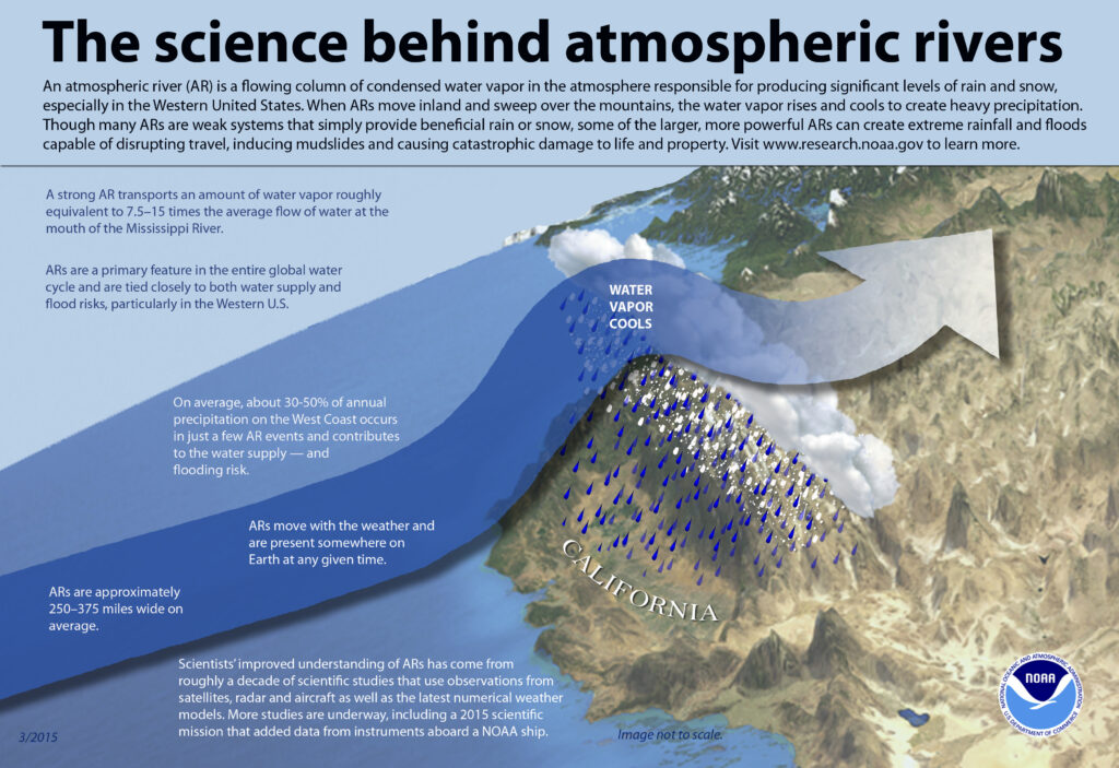
Meteorologists are warning that this next atmospheric river event will hit Wednesday with the worst likely from Wednesday afternoon into early Thursday An atmospheric river refers to a narrow stream of concentrated moisture in the atmosphere. The most common atmospheric river event is nick-named “Pineapple Express”; in this type of situation, a robust stream of moisture near the Hawaiian islands flows north and east into western North America, dropping copious amounts of rain and snow as it interacts with the terrain there.
These long, narrow atmospheric rivers help transport moisture from the tropics, in water vapor form, to areas far from the tropics. The liquid equivalent of these moisture plumes could be comparable to the water flowing through the mouth of the Mississippi River, according to NOAA.
On top of heavy precipitation that fell from the last storm system, more epic rainfall amounts are projected for the next few days. Right now, the San Francisco office of the National Weather Service is calling for 4.5-6.5″ over the Santa Lucia Mountains and the Big Sur Coast; there could be amounts up to 8″ at some of the higher peaks. For the Coastal Mountains in the North Bay, 4.5-6.5″ is expected with amounts up to 7.5″ possible in the higher peaks there. In the Santa Cruz Mountains and Northern Monterey Bay, 3.5-6″ of rain is likely with amounts up to 7″ possible over higher peaks. The Interior North Bay should see 2.75-5″ while the East and South Bay will get 1.5-3″. Southern and Eastern Monterey Bay will get 2-3″ of rain while the Salinas Valley and San Benito County will get 1.5-3″.
On average, 30-50% of annual precipitation on the U.S. West Coast occurs from a few atmospheric river events. In addition to replenishing water supplies, they can also create problems associated with heavy precipitation: flooding, rock/mud slides, and avalanche dangers.

As the stream of water vapor hits the mountain ranges over the U.S. west coast, the air rises, cools, and condenses the moisture out of it. This condensed moisture falls out of the sky as heavy rain, heavy snow, or both.
Beyond this week’s event, the American GFS computer forecast model continues to show an exceptionally active weather pattern for the next 2 weeks with more Pineapple Express events expected.