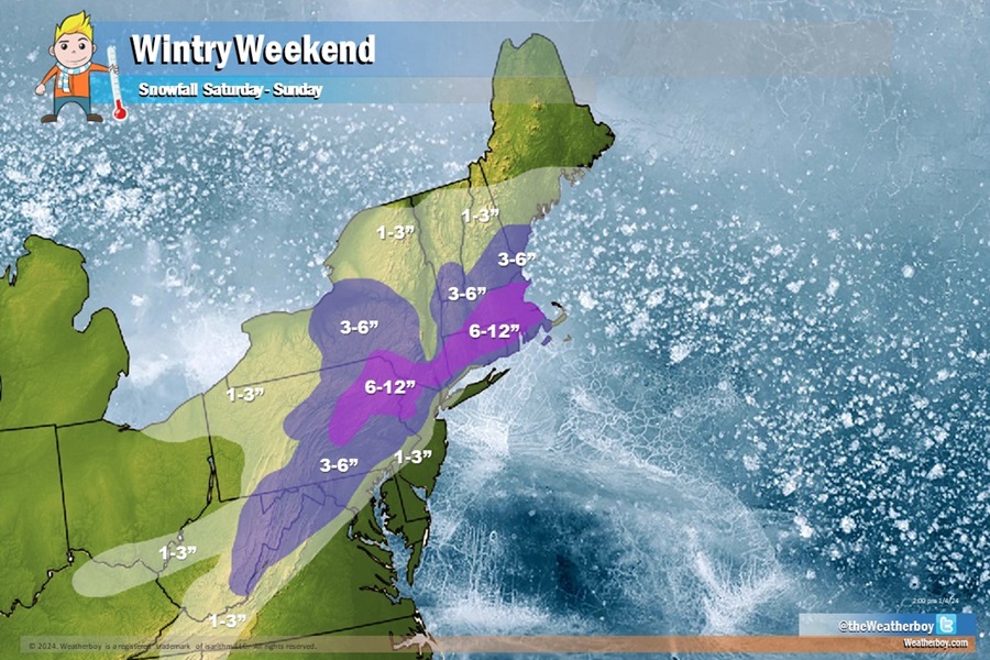
A winter storm will bring a mixed bag of precipitation to the northeast, with heavy rain along and south/east of the I-95 corridor south of New York City and heavy snow north and west of there. Some portions of north western New Jersey, northeastern Pennsylvania, and southern Upstate New York will see some of the heaviest snow totals, with some areas expecting near or just above a foot of snow before the end of the weekend.
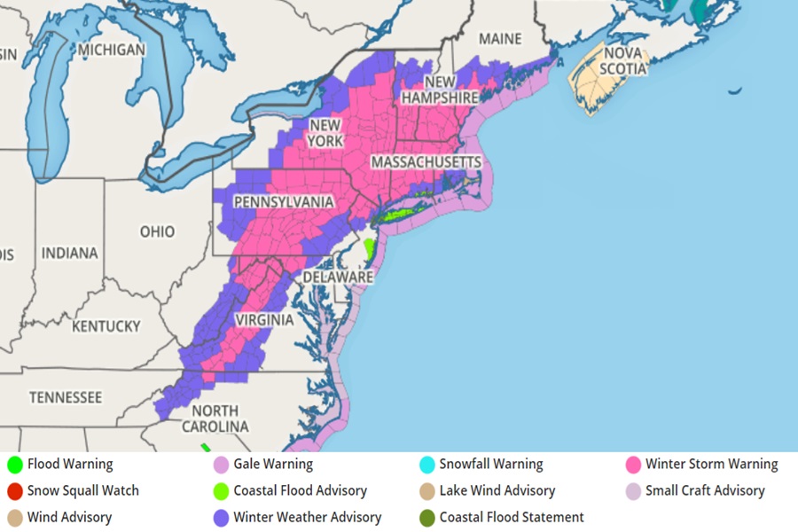
Due to the threat of significant winter storm conditions, the National Weather Service has issued Winter Storm Warnings for portions of Virginia, West Virginia, Maryland, Pennsylvania, New Jersey, New York, Vermont, New Hampshire, Massachussetts, Rhode Island, and Maine; within this area, New Jersey, New York, and Pennsylvania could end up with the highest snowfall amounts from this system.
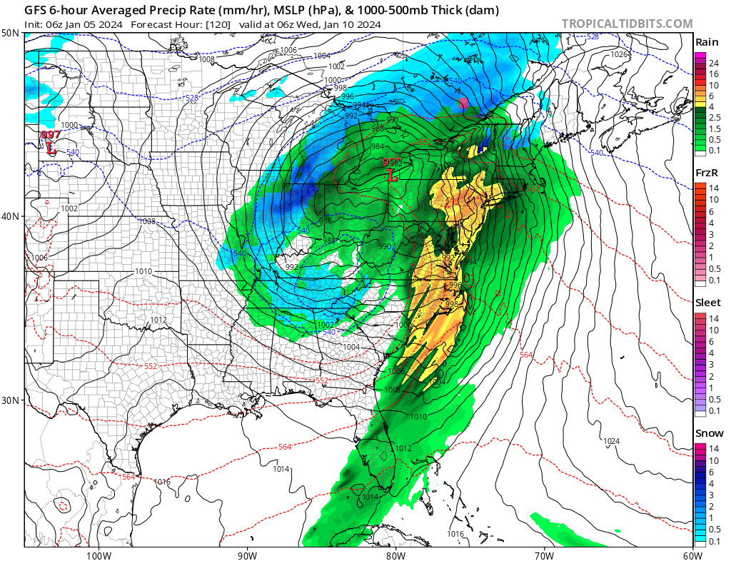
An upper disturbance centered over the Great Lakes will support a winter storm across the eastern third of the country this weekend. Heavy snow in interior portions of the northern Mid-Atlantic through New England this afternoon into Sunday. The combination of heavy, wet snow and gusty winds from northeast Pennsylvania through much of the southern and central New England will result in difficult travel with some power outages and tree damage.
Gusty onshore winds may lead to minor flooding along the Mid-Atlantic and southern New England coasts during the Sunday morning high tide cycle. The probability for ice accumulations in excess of 0.25″ along the Blue Ridge of North Carolina and Virginia are 30-50%. This icing along with some areas of sleet, may produce hazardous travel conditions today.
Meanwhile, rain showers and scattered thunderstorms are likely across the southern Mid-Atlantic and Southeast within the warm sector of the winter storm today.
While some areas will pick up several inches of snow this weekend, it’s likely to be washed away as a stronger, more significant storm heads east. Gusty winds on the warm side of the storm may exceed 50 mph and cause damage over the Appalachians to the East Coast. Organized severe thunderstorms are possible along the Gulf Coast and Southeast Monday and Tuesday. There is also a Slight Risk (at least 15%) of Excessive Rainfall leading to Flash Flooding across portions of the central Gulf Coast on Monday.
This next system is likely to be milder than the weekend system, which will help transport heavy rain over areas that see accumulating snow this weekend. With that snowmelt, there could be additional flooding problems, especially over southern New York, northern New Jersey, and northeastern Pennsylvania.
Heavy rain and strong thunderstorms will likely prompt the National Weather Service to issue a variety of watches and warnings Tuesday into Wednesday; these can include Severe Thunderstorm and/or Tornado Watches and Warnings, Flood Advisories, Coastal Flood Warnings, and Wind Advisories. Unlike this weekend storm, cold air will be scarce and because of that, soaking rains are expected throughout much of New England from this next storm.
