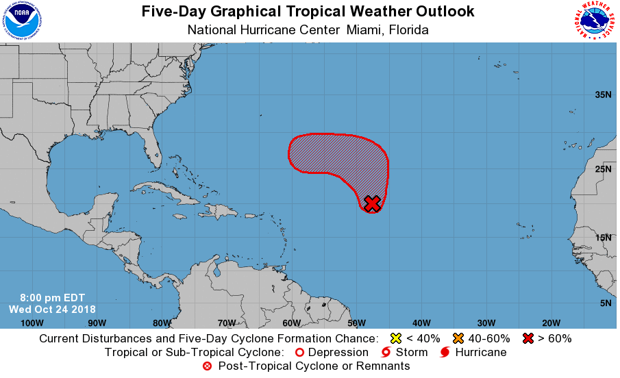
After a lull in the tropics after Hurricane Michael’s impacts, it appears things are heating up again. In a Tropical Outlook released by the National Hurricane Center today, it is likely a new tropical cyclone is forming in the central Atlantic.
A large area of disturbed weather over the central tropical Atlantic Ocean is associated with a broad area of low pressure located about 900 miles east of the northern Leeward Islands. According to the National Hurricane Center, this system has become better organized since yesterday with increased thunderstorm activity, although the low’s circulation is still not well defined. This disturbance is expected to move northward over the next couple of days into an area where environmental conditions are forecast to be generally conducive for development, and a tropical or subtropical depression or storm is most likely to form on Friday or Saturday. After that time, the system is forecast to turn westward well to the northeast of the Lesser Antilles through early next week.
Should the cyclone warrant a name, it would be called “Oscar”, the next name on the list to be used for 2018 Atlantic tropical storms and hurricanes.
While extended forecast guidance isn’t always reliable with tropical cyclones, it appears a potent nor’easter moving through the U.S. east coast this weekend will help deflect this storm away from the U.S. Computerized model forecasts from Europe, Canada, and America are all aligned to the idea that the strong nor’easter will help lift this new system up into the Northern Atlantic and eventually absorb it, protecting the northeast coast and Canada from any tropical or subtropical cyclone impact at this time.