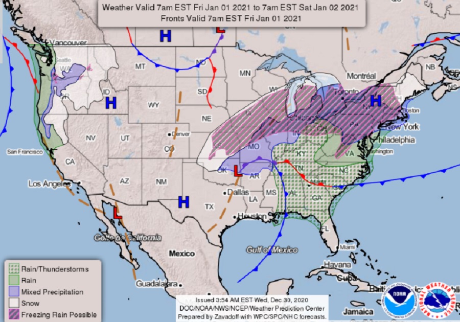
2020 will end on a soggy note while 2021 will kick-off with a wintry mess over a large part of the Eastern United States. 2021 will also start with coastal rain and mountain snow over the Pacific northwest.
A complex weather system will evolve over the next 48 hours, bringing a mixed bag of weather to the eastern United States. A northern stream trough currently over the Dakotas and Minnesota will move east and northeast, eventually becoming centered near Newfoundland by late Thursday night. This initial disturbance will bring light precipitation, mainly rain, into portions of the Mid Atlantic and Northeast tonight. However, some colder higher elevations could see freezing rain or light snow.
On New Year’s Eve, a cold front will stall across the southeastern United States. An area of confluence will then spreads into the Northeast, which will support strengthening surface high pressure. This surface high is forecast to build near and north of the Mid Atlantic Thursday night and then become more centered over southeastern Canada and New England by Friday morning. In the wake of stalled cold front with the colder high pressure building down, a notable drier air mass will settle south and this will result in drying conditions ahead of the next wave of precipitation that’ll move north and east.
For the first day of the new year, precipitation from a milder air mass will battle with colder, drier air to the north. Strong confluence ahead of a negative tilt trough moving up the Ohio Valley will keeps a strong and cold surface high pressure centered in Upstate New York with the low-level cold wedge from about the I-95 corridor westward. The surface high is forecast to shift east with time though and with surface low pressure tracking north into the Great Lakes region. As the low moves to the Great Lakes, warming air aloft will continue to gradually erode the colder surface air mass.
With cold air in place, precipitation across much of the Great Lakes and the northeast from Pennsylvania and New Jersey north will start as an icy mix of sleet, freezing rain, and snow. In central and northern New England, precipitation will start as plain snow; in central New England, this plain snow will change to an icy mix while precipitation will remain all-snow to the north. South across Upstate New York, Massachusetts, Connecticut, Pennsylvania, central Maryland, and northwestern New Jersey, freezing rain and sleet will linger before changing to plain rain later in the day. South of there, in Virginia and Delaware and south to northern Florida, plain rain and some scattered thunderstorms will also move through. This system will be slow to move out, with precipitation continuing in portions of the northeast and southeast into the first weekend of the new year.
