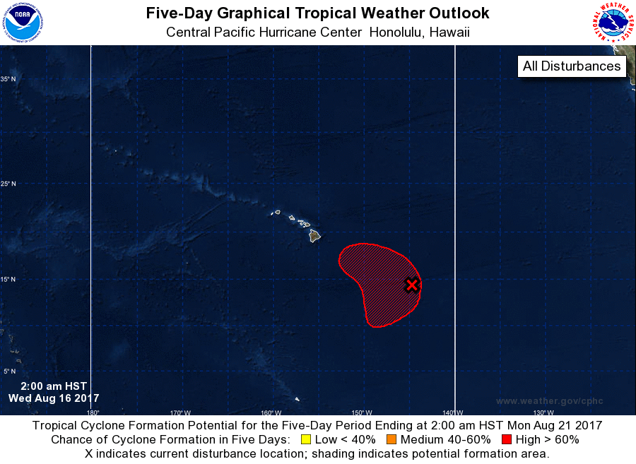
While Hurricane Gert spins about east of the New Jersey shore, eyes are on the central Pacific where the next US tropical cyclone threat may arrive. Meteorologists at the Central Pacific Hurricane Center (CPHC) in Honolulu, which is part of the National Weather Service office there, are keeping a close eye on a system that is getting better organized south and east of Hawaii’s Big Island.
According to the CPHC, showers and thunderstorms associated with a broad area of low pressure about 800 miles southeast of Hilo, Hawaii remain disorganized early this morning. However, the CPHC says that environmental conditions appear to be conducive for gradual development of this system during the next few days as it moves slowly toward the northwest. The CPHC pegs the chance of tropical cyclone formation at 60% for the next 48 hours and a high 80% within the next 5 days.
Systems in the Central Pacific, between 140W and 180W, are monitored by the CPHC rather than the National Hurricane Center in Miami. Should a storm in the eastern Pacific form and move into the CPHC domain, it will keep the name the National Hurricane Center issues it and take on advisories once it crosses 140W. However, when a storm develops between 140W and 180W, the CPHC uses their own list of rotating names that are more appropriate for the region there.
Should a tropical cyclone develop and be named here, it would be called Walaka. Beyond Walaka, the next names to be used by the CPHC are Akoni, Ema, Hone, Iona, Keli, and Lala.
