• Skip to primary navigation
  • Skip to main content
  • Skip to primary sidebar

Weatherboy

Weatherboy Weather News, Maps, RADAR, Satellite, and Forecasts.

  • Local
  • Earth Science News
  • RADAR
  • Current Warnings
  • Satellite
  • Current Maps
  • Forecast Maps
  • Video

NOAA Announces the Official Arrival of El Nino

by Weatherboy Team Meteorologist - June 8, 2023

Beyond impacting the weather across the United States, a strong El Nino could also create weather problems in Hawaii including flooding rains and run-ins with tropical cyclones like tropical storms and hurricanes. Image: Stable Diffusion AI


Experts at NOAA have announced the official arrival of El Nino today. Scientists at NOAA’s Climate Prediction Center (CPC) issued their new monthly outlook today, declaring that El Nino conditions are present now and are expected to gradually strengthen into the upcoming winter. Due to this status, the CPC has issued an El Nino Advisory.

​”Depending on its strength, El Nino can cause a range of impacts, such as increasing the risk of heavy rainfall and droughts in certain locations around the world,” said Michelle L’Heureux, climate scientist at the Climate Prediction Center

This animated loop shows the progression to the current El Nino since January. Image: NOAA
This world map shows sea surface temperature anomalies during one of the strongest El Nino events on record in 2016. The red areas indicate warmer-than-average ocean temperatures, while blue areas represent cooler-than-average temperatures. Image: NOAA

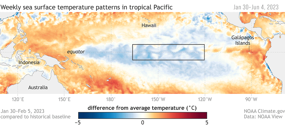
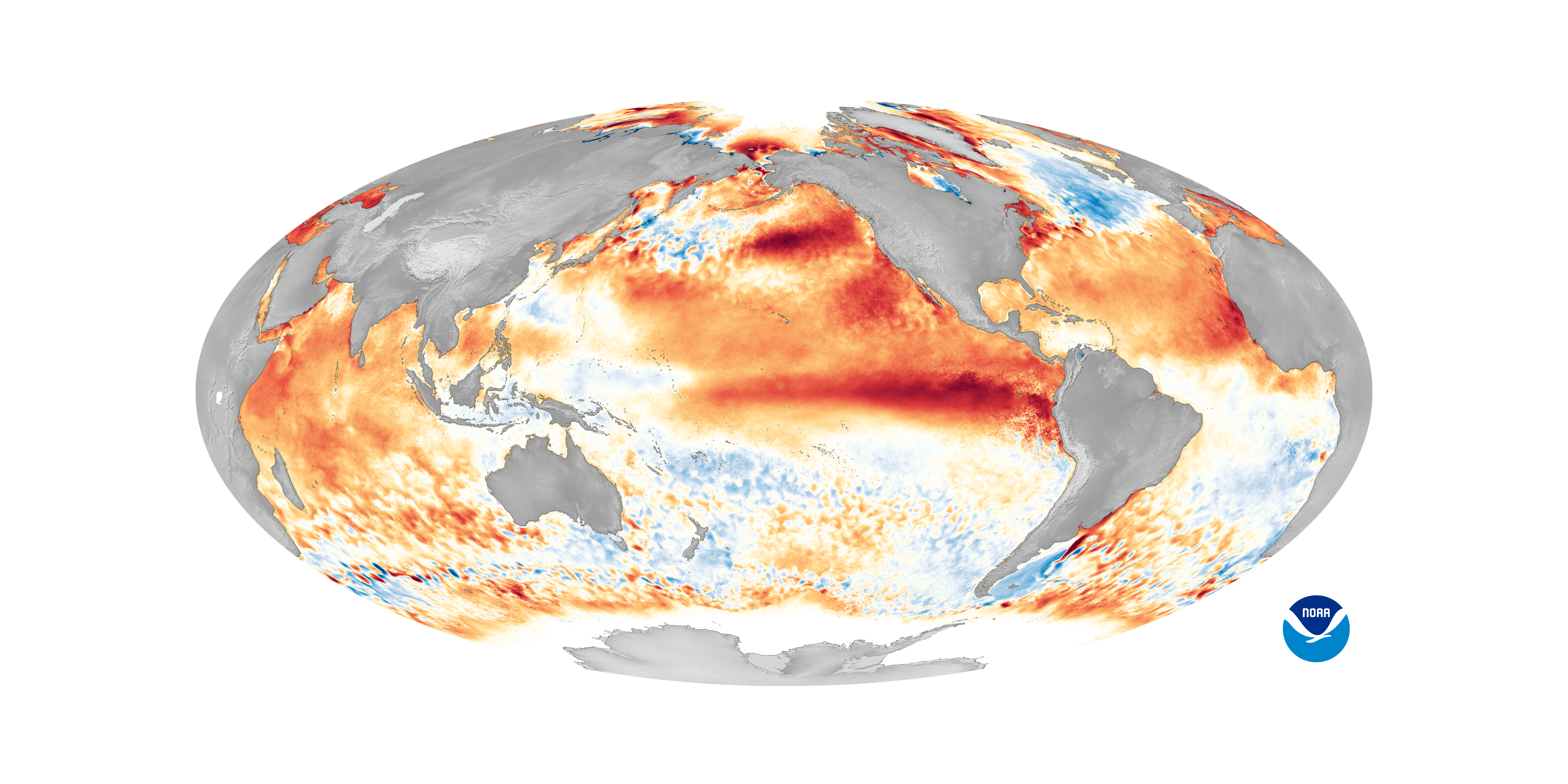
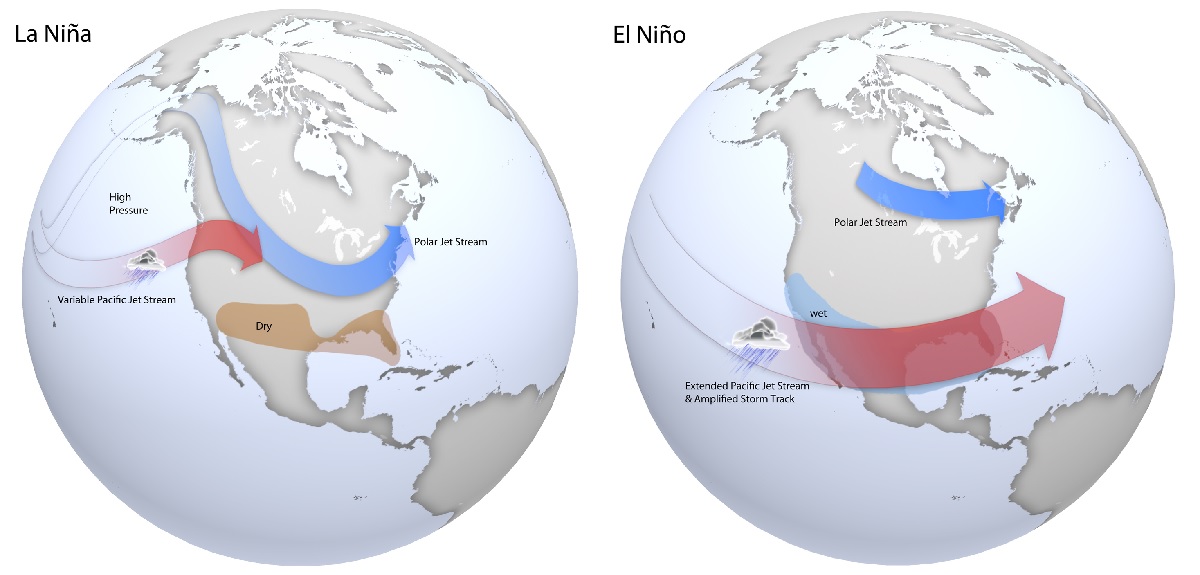
El Niño refers to a warming of the ocean surface, or above-average sea surface temperatures (SST), in the central and eastern tropical Pacific Ocean. Over Indonesia, rainfall tends to become reduced while rainfall increases over the central and eastern tropical Pacific Ocean. The low-level surface winds, which normally blow from east to west along the equator (“easterly winds”), instead weaken or, in some cases, start blowing the other direction (from west to east or “westerly winds”). In general, the warmer the ocean temperature anomalies, the stronger the El Niño (and vice-versa). While this type of warming and the impacts on global weather patterns can help disrupt the formation of tropical storms and hurricanes in the Atlantic Hurricane basin, it could help foster the development of such systems in the Pacific. El Nino is part of  ENSO.

Hawaii Governor Josh Green, M.D., chats with Central Pacific Hurricane Center Director Chris Brenchley ahead of the release of the 2023 Hurricane Season Outlook on May 25, 2023. Image: Weatherboy

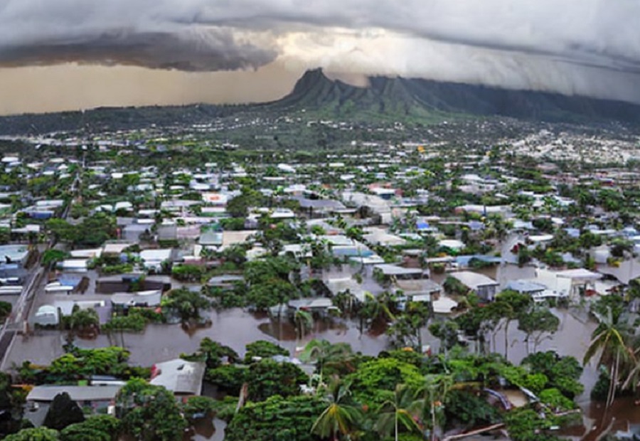
ENSO, short for El Nino Southern Oscillation, is a recurring climate pattern involving changes in the temperature of waters in the central and eastern tropical Pacific Ocean. On periods ranging from about three to seven years, the surface waters across a large swath of the tropical Pacific Ocean warm or cool by anywhere from 1°C to 3°C, compared to normal. This oscillating warming and cooling pattern, referred to as the ENSO cycle, directly affects rainfall distribution in the tropics and can have a strong influence on weather across the United States and other parts of the world. El Niño and La Niña are the extreme phases of the ENSO cycle; between these two phases is a third phase called ENSO-neutral. While this phenomena impacts the entire United States, Hawaii may find itself particularly vulnerable this year to bad weather conditions.

El Nino’s influence on the continental United States is generally weak during the summer and more pronounced starting in the late fall through spring. By winter, according to the CPC,  there is an 84% chance of greater than a moderate strength El Nino, and a 56% chance of a strong El Nino developing. Typically, moderate to strong El Nino conditions during the fall and winter result in wetter-than-average conditions from southern California to along the Gulf Coast and drier-than-average conditions in the Pacific Northwest and Ohio Valley. El Nino winters also bring better chances for warmer-than-average temperatures across the northern tier of the country.

El Nino also significantly impacts Hawaii’s weather. In addition to making conditions more favorable for tropical cyclone development during hurricane season, a strong El Nino can also create severe drought conditions in the Aloha State.


Typical late fall through early spring upper level jet stream positions associated with moderate to strong La Niña (left) and El Niño (right) events. During La Niña, a variable Pacific jet stream in association with a polar jet stream shifted further south favors below normal precipitation across the southern US, with below normal temperatures across the northern US. During El Niño, a strong and amplified Pacific jet stream extending across the southern US in association with a polar jet stream shifted further north into Canada favors above normal precipitation across the southern US, and above normal temperatures over the northern US. Image: NOAA


El Niño conditions could linger for a year, but sometimes longer. Conditions can start as early as March and peak in December. This event is called “El Niño”, Spanish for the Christ Child, which impacted Spanish speaking country’s weather and fishing industries around Christmas time.

La Niña refers to a cooling of the ocean surface, or below-average sea surface temperatures (SST), in the central and eastern tropical Pacific Ocean. Over Indonesia, rainfall tends to increase while rainfall decreases over the central and eastern tropical Pacific Ocean. The normal easterly winds along the equator become even stronger. In general, the cooler the ocean temperature anomalies, the stronger the La Niña (and vice-versa). The presence of this cooling usually leads to a quieter Central Pacific and Eastern Pacific hurricane basin during hurricane season, but could lead to above normal conditions in the Atlantic hurricane basin in hurricane season.

Primary Sidebar

Sponsored Ad

Search

Latest News

  • Volcano in Hawaii Explodes to Life, Prompting USGS to issue VOLCANO WATCH
  • Destructive Wind and Tornado Threat Today in New Jersey, Pennsylvania, Maryland, Delaware, and Virginia
  • Erick Grows Into Category 4 Hurricane, Strikes Land
  • Elevated Threat of Tornadoes Across Northeast on Thursday
  • Tropical Storm Erick Forecast to Become Strong Hurricane
  • National Hurricane Center Says Dalila is Gone But Erick Is On the Way
  • Overnight Earthquake Rocks Eastern Tennessee
  • Hot Week Ahead
About | Careers | Contact | Contests
Terms | Privacy | Ad Choices
Weatherboy is a (R) Registered Trademark of isarithm LLC, All Rights Reserved.
All content herein is Copyright by Isarithm LLC 1997-2022