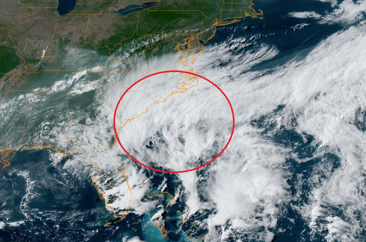
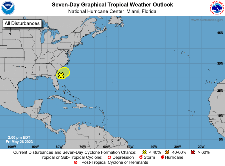
A non-tropical cyclone continues to develop along the U.S. East Coast, setting the stage for a wet and windy first part of the Memorial Day holiday weekend. While local offices from the National Weather Service are tracking the system, the National Hurricane Center in Miami, Florida is also monitoring the system for any signs of tropical development. The 2023 Atlantic Hurricane Season officially begins next week on June 1, but sometimes systems do develop in the off-season. At this time, the National Hurricane Center (NHC) does not believe this system will take on more tropical characteristics.
According to the National Hurricane Center, there is only a 10% chance that this system will become tropical in nature sometime over the next two days. For now, disorganized showers and thunderstorms located near the southeastern United States coast are associated with a non-tropical low pressure area and associated frontal boundary. “The low is unlikely to become a subtropical or tropical cyclone since it is forecast to remain frontal while moving generally northward and inland over the Carolinas late Saturday or Sunday,” the NHC said today in an updated Tropical Outlook.
Nevertheless, the system is expected to continue producing gusty winds, and dangerous surf and rip current conditions along portions of the southeastern United States coast through Sunday. Heavy rainfall is expected in portions of the Carolinas and Virginia during the next couple of days. Hazardous marine conditions are also expected over the coastal and offshore waters where gale and storm warnings are in effect.
While a transition to a tropical system is unlikely, the National Weather Service does say that this system will have a chance to gather some strength over the warm waters off Florida and Georgia as it heads north toward the Carolinas on Saturday before moving west into the Carolinas by Sunday morning. “Strong winds and anomalous moisture will help to strengthen the low, generating high waves making for beach and boating activities to be quite hazardous,” the National Weather Service (NWS) cautioned. High Surf Advisories have been posted for portions of Georgia and South Carolina coasts already and life threatening rip currents are to be expected for much of the Southeast. Boating conditions will also be quite treacherous with a Storm Warning issued by the Ocean Prediction Center and NWS Forecast Office in Charleston and parts of South Carolina’s offshore waters with a broad Gale Warning up through the Florida East Coast to southeastern Virginia and northern North Carolina waters.
Inland, strong showers and thunderstorms should be numerous with high rainfall potential. The Weather Prediction Center of the National Weather Service has issued a Moderate Risk of Excessive Rainfall for parts of the South Carolina / North Carolina Coastal Plain for Saturday, while a broader Slight Risk extends across much of the Carolinas. In this area, instances of flash flooding could be common.
The areal coverage of showers and thunderstorms will result in a very cloudy day on Saturday, with numerous record low maximum temperatures expected with highs in the 50s in the upstate South Carolina and parts of North Carolina and only 60s in the Low Country, generally 20 to 30 degrees below average.
This system is expected to rain itself out over West Virginia and Virginia on Sunday, not able to move too far north into the northeast due to the presence of high pressure there. The heavy soaking rains aren’t expected to advance north of Virginia; while showers are possible in portions of Delaware, Maryland, New Jersey, and Pennsylvania, any heavy rain from this system is expected to fall to the south before an upper low drags the disturbance out to sea.
