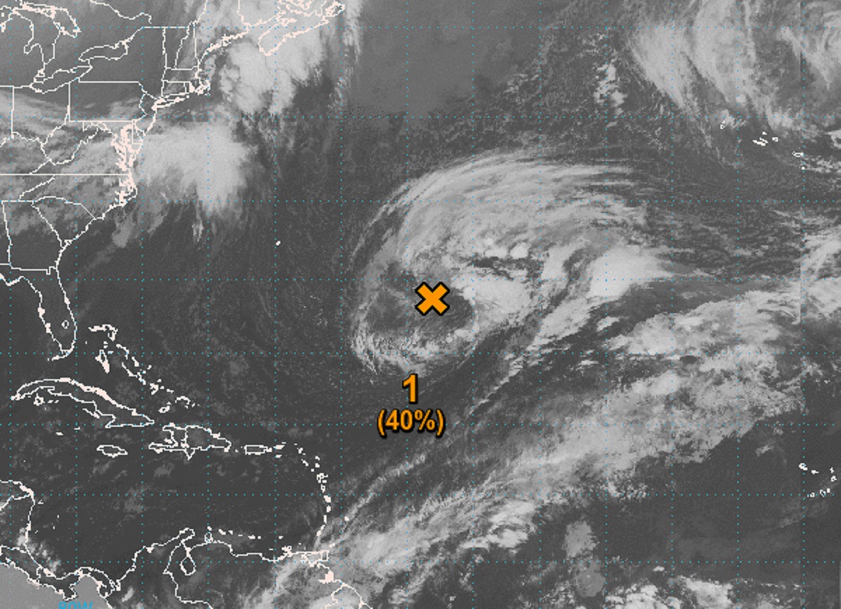
While the National Hurricane (NHC) boosted odds that a system in the Atlantic would develop into a tropical or subtropical storm, in a Special Tropical Outlook released a short time ago, the NHC says the odds of storm formation have decreased there for the week. The latest GOES-East Weather Satellite loop shows a huge storm system spinning about in the open waters of the Atlantic; while the storm system will still be problematic for trans-oceanic shipping lanes, it is now less likely to take on characteristics of a tropical or subtropical storm.
The area of concern consists of a large non-tropical area of low pressure located over the central subtropical Atlantic about 950 miles northeast of the northern Leeward Islands. At this time, the storm system is producing an extensive area of disorganized showers and thunderstorms. According to the NHC, although this system may acquire some subtropical characteristics tonight and Thursday, it is unlikely to become completely detached from a frontal zone. Because of that, it is unlikely to take on enough tropical storm or subtropical storm characteristics to become one. As such, the NHC has lowered the odds of tropical or subtropical storm formation over the next 48 hours to 40%.
By Friday, this storm system is forecast to move northeastward over cooler waters and interact with a mid-latitude trough. This interaction will limit the chance for additional subtropical or tropical development of the system.
While the National Hurricane Center isn’t issuing any advisories on this system because it isn’t a tropical or subtropical storm, the National Weather Service is through their High Seas Forecasts.
The 2022 Atlantic Hurricane Season ended on November 30. While it is the off-season now until the new season begins on June 1, 2023, storms do form from time to time in the Atlantic outside of the traditional season.