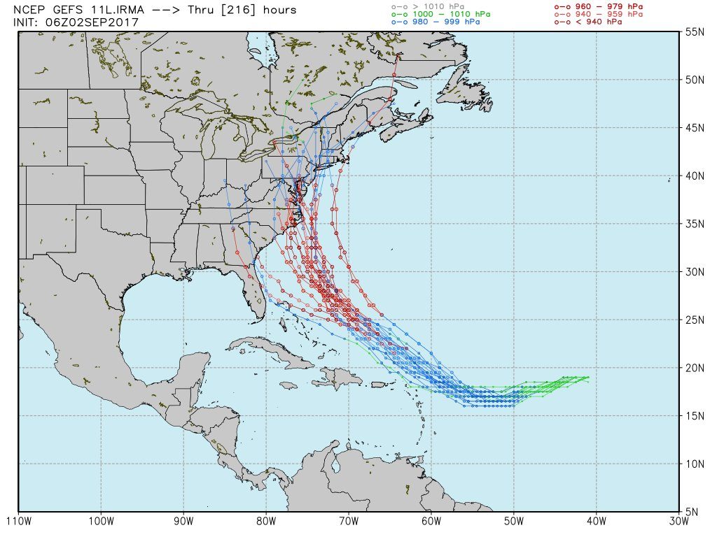
Odds of a major east coast landfall continue to increase with each passing hour as Major Hurricane Irma continues to track across the open waters of the Atlantic Ocean. While a potential landfall is still more than 5 days away and forecast accuracy and reliability from global forecast models has not yet been perfected at this range, one cannot easily dismiss the idea that the American GFS and European ECMWF forecast models have been suggesting for multiple runs: that a East Coast landfall will occur. The National Hurricane Center official forecasts only go out 5 days, and even those forecasts see decent forecast error in the 4th and 5th day. With a potential landfall 7-10 days away, meteorologists are still about 2-3 days away from being reasonably confident in the future track of Irma. In addition to forecast track, the future intensity of Irma is also in question and skill level associated with forecasting intensity is lower than forecasting the path. Some guidance has suggested Irma could become a Category 4 storm or worse at landfall, although a lot, such as eye wall replacement cycles, could fluctuate the intensity of even a very strong hurricane right before landfall.

What are the odds of two back-to-back catastrophic hurricanes in light of Hurricane Harvey’s destruction in Texas and Louisiana? It has happened before. According to leading seasonal hurricane forecaster Dr. Phil Klotzbach, 2005 saw back-to-back hurricanes Rita and Stan retired from the name list. Hurricane Rita was the fourth-most intense Atlantic hurricane ever recorded and the most intense tropical cyclone ever observed in the Gulf of Mexico at the time; it eventually created $12billion in damage and was responsible for 120 deaths, although many of those deaths were from accidents in the mass evacuation of the Houston area. Hurricane Stan was a weak but deadly hurricane that struck central America; that category 1 storm caused $3.96billion in damages but was responsible for 1,668 deaths. While it is yet far from definitive whether or not Irma will be a costly, deadly hurricane, past events show it could happen again.
To prepare for that possibility, the National Hurricane Center is scheduled to begin reconnaissance missions into the storm starting on Sunday, September 3. In the afternoon, P-3 tail doppler RADAR missions will be launched on Hurricane Irma every 12 hours. On Monday, September 4, 6- hourly fix missions on the hurricane will begin. A G-IV aircraft will also launch on a synoptic surveillance mission around Irma to better understand the environment it’s in and heading into to assist with forecasting the storm’s path and intensity.
Residents of the East Coast only need to do two things at this time: make sure they have a Hurricane Action Plan and make sure they pay attention to evolving official forecasts for Irma. While no hurricane or tropical storm will impact the US East Coast this Labor Day Holiday weekend, the same may not be true for the following weekend. If that happens, residents somewhere along the US East Coast may need to put their Hurricane Action Plan into action during the middle to later part of next week.
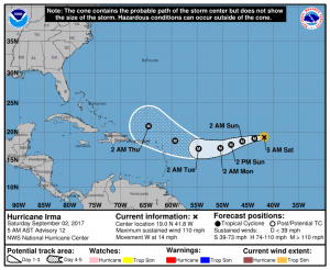
The National Hurricane Center (NHC) shows in their latest five day forecast that Irma could be north of Puerto Rico as a Major Hurricane in Day 5. Both the National Weather Service and National Hurricane Center warn the public of the dangers of “fake maps” being shared on the internet; they stress that National Hurricane Center forecast maps only go 5 days out in the future and any maps that appear to be issued by them for beyond 5 days are “fake.” As part of peoples’ Hurricane Action Plans, they should make sure they have reliable weather resources they can trust and avoid weather sources that lack any meteorological education or credibility.
Experts believe this Atlantic Hurricane Season, which runs through to the end of November, will be a busy one. Dr. Phil Klotzbach and the experts at Colorado State University updated their seasonal outlook again on July 5, showing a much more active than normal season expected. The National Oceanic and Atmospheric Administration (NOAA) also released their own forecast which shows this hurricane season to be likely more active than others.