While some computer forecast runs in recent days have been suggesting that a “bomb cyclone” would impact the northeast –just days after a historic snowstorm left record-breaking snowfall– it appears unlikely such a storm will form at this time.
As recently as yesterday, the European ECMWF computer forecast model was suggesting that an area of low pressure moving up from the south east would rapidly intensify, bringing wind-whipped heavy snow back to portions of the Mid Atlantic and Northeast. However, there is good agreement with recent runs and with different computer forecast models that such a nor’easter situation won’t unfold.
The ECMWF is one of many computer models meteorologists use to assist in weather forecasting. While meteorologists have many tools at their disposal to create weather forecasts, two primary global forecast models they do use are the ECMWF from Europe and the GFS from the United States. While the models share a lot of the same initial data, they differ with how they digest that data and compute possible outcomes. One is better than the other in some scenarios, while the opposite is true in others. No model is “right” all the time. Beyond the ECMWF and GFS models, there are numerous other models from other countries, other academic institutions, and private industry that are also considered when making a forecast.
With the storm that dropped more than 30″ of snow over portions of New Jersey and Pennsylvania, the ECMWF outperformed the GFS in terms of modeled upper atmospheric dynamics, surface weather conditions, and ultimate precipitation types and amounts well in advance of the storm’s impact. Because of it’s superior performance, some thought the model could be onto something when it came to the upcoming weekend storm.
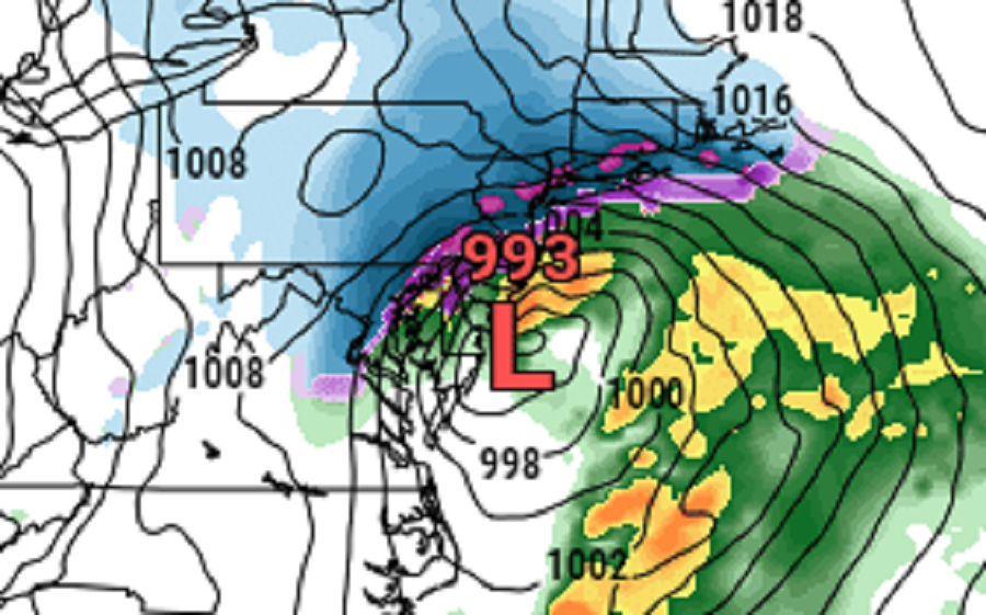
For several runs, the ECMWF suggested a “bomb cyclone” would form. A “bomb cyclone” refers to the meteorological process of explosive cyclogenesis. Similar to a rapidly intensifying hurricane in the tropics in hurricane season, a bomb cyclone refers to a storm and a process in which atmospheric pressure drops quickly, the storm intensifies, with wind and precipitation increasing. In general, a bomb cyclone is a storm system that experiences a drop of at least 24 millibars (mb) within a 24 hour period. Yesterday’s ECMWF run suggested that the storm would start with a surface low of 1008 mb dropping to 977 mb, a drop of 31 mb, as it moved up the coast.
If the storm materialized, it would bring very heavy rain and heavy snow, along with more high wind and coastal flooding issues. Areas that saw more than 2 feet earlier this week could have seen just as much if not more.
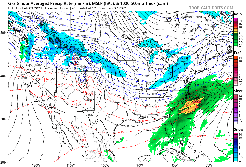
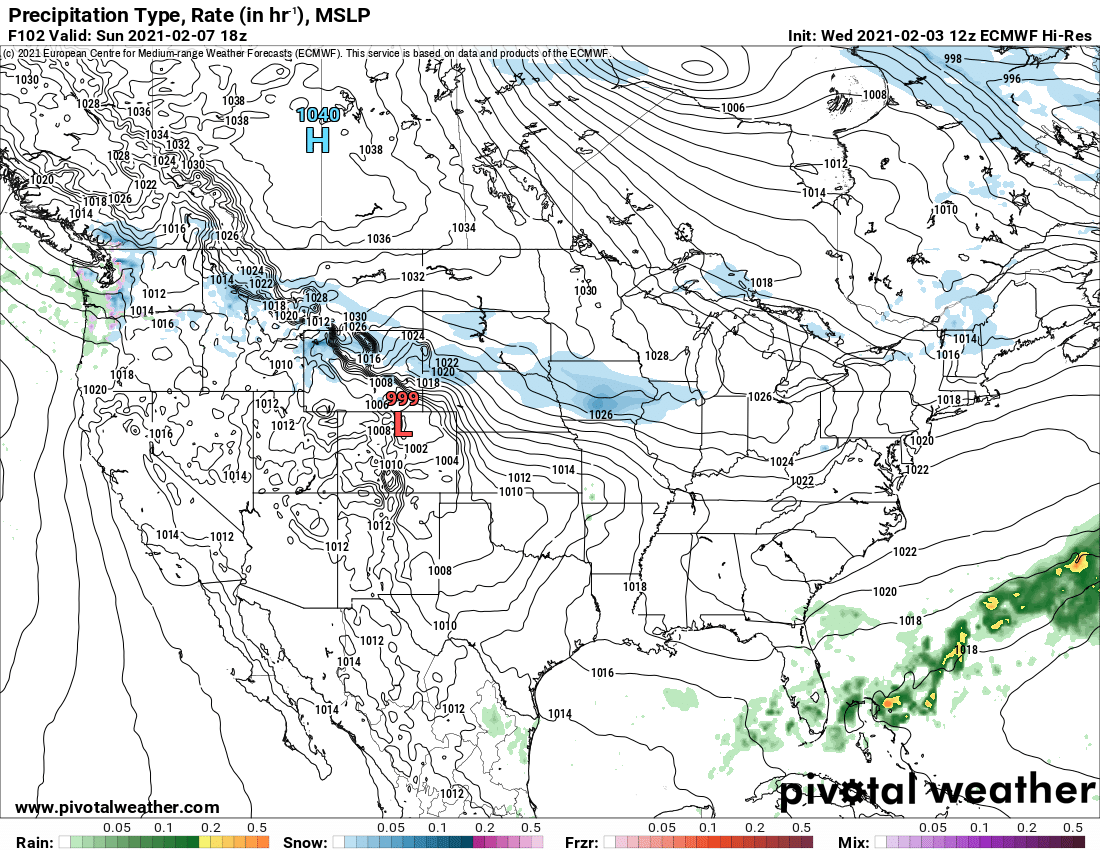
However, the ECMWF and other global forecast models have since reversed course, showing that pieces of energy that could have united to created a bomb cyclone won’t interact, or phase, to create such a storm. Both the GFS and ECWMF show an area of low pressure sliding off of the southeast coast, unable to connect with a disturbance tied to an Arctic cold front moving through the Great Lakes region. Because there’s no phasing here, there can be no bomb cyclone.
While model solutions will continue to evolve in the coming days as new data is captured and digested, odds are fading that phasing will occur. Because those odds are fading rather than increasing, and confidence is increasing among meteorologists that the storm system is unlikely to form the bomb cyclone initially thought possible, the chance of another historical snowstorm in the northeast is very low.
