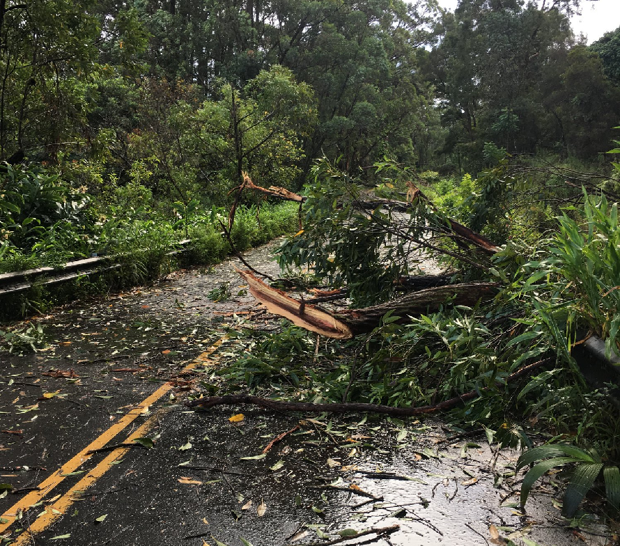
Tropical Storm Olivia is impacting Hawaii now, hitting the islands of Molokai and Maui the worst. At this time, a Tropical Storm Warning remains in effect for Oahu and Maui County; Maui county includes the islands of Maui, Molokai, Lanai, and Kahoolawe. A Tropical Storm Warning means that tropical storm conditions are expected or occurring somewhere in the warning area.
Yesterday, on the Big Island which is Hawaii County, officials set up sand distribution centers to help residents bag for sand bags to block flood waters from their property. Hawaii County also opened up an emergency storm shelter for residents in Waimea. However, as forecast, impacts to the Big Island were minimal with light rain and inconsequential winds. However, rough surf has battered the island, forcing officials to close many beach parks there.
On Maui, closer to the center of the storm, the impacts have been felt moreso than elsewhere in the Aloha State. More than 8 inches of rain already fell on parts of Maui with more rain on the way. Officials on Maui were encouraging people not to travel to/from eastern portions of the island until the storm passed.
As of 11am HT / 6pm ET, Tropical Storm Olivia was located near latitude 20.9 North, longitude 157.1 West, which is just west of the island of Lanai. Olivia is moving toward the west near 15 mph. A turn toward the west-southwest will occur today, with a similar west-southwest motion expected through Friday. Maximum sustained winds are near 45 mph with higher gusts. Tropical-storm-force winds extend outward up to 90 miles from the center. The estimated minimum central pressure is 1005 mb or 29.68 inches. The Central Pacific Hurricane Center (CPHC) expects the storm to weaken over time.
In the meantime, the CPHC expects hazards to persist today. Tropical storm conditions are ongoing in Maui County and tropical storm conditions are expected over Oahu later today. Wind gusts can be much stronger near higher terrain, and in the upper floors of high-rise buildings. Winds can also be especially gusty through gaps between mountains and where winds blow downslope. Showers will continue to increase over the main Hawaiian
Islands today. Olivia is expected to produce total rainfall accumulations of 5 to 10 inches in some areas, with isolated maximum amounts of 15 inches possible, especially in higher terrain. This rainfall may produce life-threatening flash flooding.
Large swells generated by Olivia will impact the main Hawaiian Islands through tonight. This will result in dangerously high and potentially damaging surf, mainly along exposed east facing shores. Even experienced swimmers and surfers are encouraged to avoid the ocean until Olivia has passed.