The third part of a winter weather mess appears to be turning more into a fizzle than a grand finale. On Friday, an area of low pressure brought mild air and heavy rain far north into New England. The Arctic cold front the low moved along from aggressively blew through the northeast early today, creating damaging wind gusts for some. More noticeably, the front brought plunging temperatures, with temperatures 25-40 degrees colder than they were 24 hours prior in places like Massachusetts, New York, Connecticut, New Jersey, Pennsylvania, Maryland, Delaware, and New Jersey. The first part of the wintry mess –rain up New England and snow into the Ohio River Valley, occurred as forecast. The second part –the arrival of the Arctic front and a changeover to frozen and freezing precipitation in the Northeast also occurred as forecast, although the front blew through faster east than expected. The third part, a Clipper which was to intensify as it neared the coast, no longer appears to be happening later Tuesday into Wednesday.
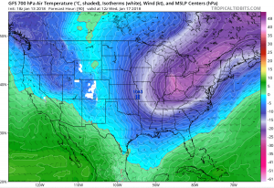
While snow is forecast in places like Delaware, New Jersey, Pennsylvania, New York, Connecticut, Virginia, and Maryland, it won’t be nearly as much as initially forecast. The Clipper system diving into the Mid Atlantic from the Great Lakes appears to be moving too fast to sync up with energy off the Mid Atlantic to spawn a more sizable system for the region. Because the flow is more zonal than amplified, the Clipper will scoot through, providing some light snow shower activity as it moves through. It appears the system will intensify as it moves away from the United States, producing another round of significant snow far out to sea. Because of the speed and trajectory of the system, that intensification should occur far enough out to sea to not create significant accumulating snow problems over land.
While there are chances that the intensification system could occur closer to the coast late Tuesday into Wednesday, which would translate to significant accumulating snow in the Mid Atlantic and southeastern New England, those chances right now are slim at best. This is great news for people fearing a wintry grand finale to a three-party messy weather situation. But it is also a bust for snow lovers eager to get more snow after the Blizzard of 2018 brought heavy snow to the region just two weeks ago. Nevertheless, meteorologists will continue to monitor this system in case it does show signs of intensification closer to the coast.