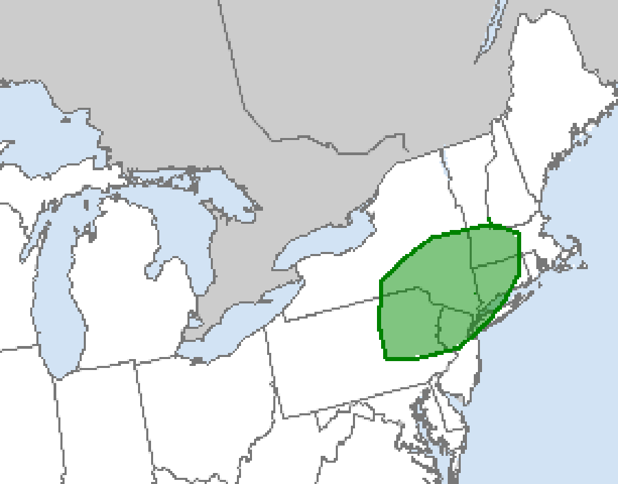
The National Weather Service’s Storm Prediction Center (SPC) says there’s an elevated risk of tornadoes tomorrow over portions of New Jersey, New York, Pennsylvania, Connecticut, and Massachusetts. Isolated strong to severe storms will be possible across portions of the northern central Plains on Saturday, but the greatest risk of tornadic cells will be over portions of the northeast.
According to the SPC, a belt of modestly enhanced mid-level southwesterly flow should be maintained Saturday across much of the Northeast and Mid-Atlantic ahead of a positively tilted upper trough. At the surface, a weak low pressure system is forecast to develop from the lower Great Lakes across New York state and into southern New England by Saturday evening. A cold front should extend southwestward from this surface low across the Mid-Atlantic and into the central Appalachians, while a weak warm front extends across southern New York and southern New England. The SPC believes that multiple clusters of storms will develop along and ahead of the cold front and a pre-frontal trough throughout the day, and subsequently move eastward across the warm sector. The SPC says that daytime heating of the moist low-level airmass ahead of these storms will likely foster steepened low-level lapse rates and moderate to strong instability, particularly across the Mid-Atlantic east of the Appalachian and Blue Ridge Mountains. In this area, isolated damaging wind gusts should be the main threat. Both low-level and deep-layer shear may be slightly stronger across southern New York and New England, and marginal supercells posing both an damaging wind and brief tornado threat appear possible, particularly in the vicinity of the weak warm front.
While not everyone will see a thunderstorm on the otherwise party cloudy afternoon, the threat is there …as is the threat for some thunderstorms to develop a tornado or two. As such, people are encouraged to keep an eye to the sky for changing conditions and be alert should the National Weather Service issue any Severe Thunderstorm Watch or Warning or a Tornado Watch or Warning during the afternoon or early evening hours on Saturday.
