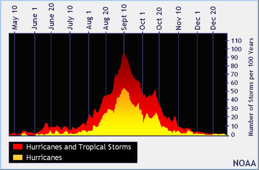
Today marks the typical peak of the Atlantic Hurricane season which begins on June 1 and runs through the end of November. Typically, this date marks more tropical cyclone activity in the basin more so than any other date when records of the last 100 years are studied.

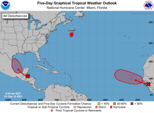
Right on cue, the Atlantic is busy today with one named storm and two more expected to develop soon. Hurricane Larry is moving north to Newfoundland after brushing by Bermuda yesterday. A new system is forecast to take shape in the western Gulf of Mexico while another is forecast to develop off the coast of Africa.
Hurricane Larry is located about 650 miles southwest of Cape Race, Newfoundland. With maximum sustained winds of 85 mph and an estimated minimum central pressure of 968 mb or 28.59″, the category 1 hurricane is moving to the north-northeast at 26 mph. With Larry moving quickly towards Newfoundland, time is running out for people there to prepare for impacts. Hurricane-force winds, dangerous storm surge, and heavy flooding rains are expected tonight.
Ahead of Larry’s arrival, a Hurricane Warning has been issued for southeastern Newfoundland from Arnold’s Cove to Jones Harbour. A Tropical Storm Warning is in effect for southeastern Newfoundland from Francois to west of Arnold’s Cove and for the area north of Jones Harbour to Fogo Island. A Hurricane Warning means that hurricane conditions are expected somewhere within the warning area, in this case within the next 24 hours. A Tropical Storm Warning means that tropical storm conditions are expected somewhere within the warning area, in this case within the next 12 hours.
Beyond Larry, another area of concern will likely be in the Gulf of Mexico in the coming days. The northern portion of a tropical wave is producing disorganized showers and thunderstorms over Honduras, the western Caribbean Sea, and portions of the Yucatan peninsula. According to the National Hurricane Center (NHC) in Miami, Florida, this system is forecast to move into the Bay of Campeche and merge with a pre-existing surface trough located over the southwestern Gulf of Mexico by this weekend. According to the NHC, environmental conditions are expected to be conducive to support gradual development and a tropical depression is likely to form Sunday or Monday before the system moves onshore along the western Gulf of Mexico coast. For now, the NHC believes there’s a 70% chance of tropical cyclone formation here within the next five days. Even if the system doesn’t take shape, heavy flooding rains are likely across portions of Central America through Saturday.

A system moving off the coast of Africa also has a 70% chance of becoming a tropical cyclone over the next 5 days. The strong tropical wave is expected to emerge off of the west coast of Africa by tonight. According to the NHC, environmental conditions are forecast to be conducive for gradual development thereafter, and a tropical depression is likely to form late this weekend or early next week as the system moves west-northwestward over the far eastern Atlantic near the Cabo Verde Islands. The National Hurricane Center cautions interests in the Cabo Verde Islands to closely monitor the future progress of this storm.
Elsewhere in the Atlantic basin there is no sign of tropical development in the next few days. The same is true for the Central Pacific Hurricane Basin which surrounds Hawaii, where no tropical cyclones exist nor are any expected to form over the next five days.