A post-Easter nor’easter is forecast to bring wind-whipped heavy rain and snow to portions of the northeast over the coming days. According to long range forecasts, this may be the last threat of significant snow in the northeast until next winter rolls around.
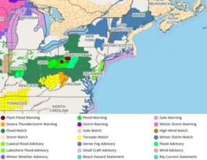
Heavy snow will fall over the Upper Great Lakes and Upper Mississippi Valley today into tomorrow; this heavy snow will spread over Upstate New York and Northern New England later tomorrow into Thursday. While heavy snow falls on the northern side of this storm, there is also a moderate risk of severe thunderstorms over parts of the Ohio Valleys today and over parts of the Mid-Atlantic and Florida peninsula on Wednesday. There is also a threat of excessive rainfall over parts of the Lower Great Lakes, Ohio and Tennessee Valleys, and Central Appalachians today.
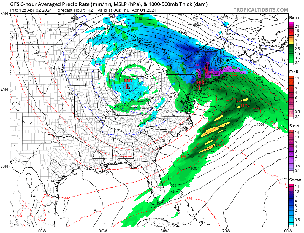
A deep storm system over the Middle Mississippi and Ohio Valleys will move to Southern New England by Thursday. The system will produce a large, long-duration winter storm, producing gusty winds and late-season heavy snow across portions of the Great Lakes and the Northeast from Tuesday into Friday.
The same storm will produce Northeast snow and wind Wednesday-Friday. Secondary low-pressure development along the Mid-Atlantic coast will bring heavy, wet snow and some sleet to the Northeast Wednesday afternoon through Friday. Significant snow accumulations are likely over Upstate New York and Northern New England. The system will create significant impacts from heavy snow and wind, and the combination of heavy snow rates and gusty winds will create hazardous travel due to low visibility and snow-covered roads. The wet snow and high snow load may also damage trees and impact infrastructure.
Along the associated front extending from the Mid-Atlantic to the Ohio/Middle Mississippi Valleys, showers and severe thunderstorms will develop over parts of the Ohio/Tennessee Valleys. The hazards associated with these thunderstorms are frequent lightning, severe thunderstorm wind gusts, hail, and a few tornadoes. In addition, there is an increased threat of EF2-EF5 tornadoes over parts of the Ohio/Tennessee/Lower Mississippi Valleys.
This storm will also be a significant rain maker. Excessive rainfall is likely over parts of the Lower Great Lakes, Ohio/Tennessee Valleys, and Central Appalachians through Wednesday morning. The associated heavy rain will create mainly localized areas of flash flooding, with urban areas, roads, and small streams the most vulnerable. Later Wednesday into Thursday, the threat of excessive rainfall will be limited to a portions of of northern Mid-Atlantic and Southern New England.
Winds will be gusty throughout the northeast as the storm moves through. With saturated soils in southern New England and the northern Mid Atlantic, some trees could tumble as their roots shift in the moist soil.
