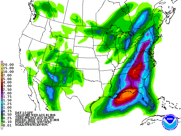
While record heat and wildfires persist in unusually dry conditions in the western US, an equally abnormal wet pattern persists in the eastern US with more soaking rains on the way. The National Weather Service is prediction a widespread 2″+ rainfall from New Jersey to Florida over the next five days, with up to 5″ of rain possible in some areas.

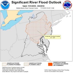
While the heaviest rain over the next 48 hours will be anchored over portions of the southeastern US, especially Florida and Georgia, meteorologists are also concerned about flood threats back in the northeast. The National Weather Service’s Mid Atlantic River Forecast Center has issued yet another Flood Outlook, showing portions of New Jersey, Maryland, New York, Virginia, and Pennsylvania at risk of more flooding as August begins. Because this area was hit hard by heavy rains last week, it won’t take much new rain to return area streams and rivers to or above flood stage again.
The heaviest rain will remain inland away from the coast. A half-inch or less of rain is expected over much of Long Island, the Jersey Shore, Delaware Beaches, and the Atlantic coast of Maryland. However, clouds will persist, continuing a prolonged stretch of time that feature more dreary conditions than sunny ones.
Long range guidance isn’t indicating any changes to the pattern anytime soon. The latest American and European global forecast guidance each suggests this wet pattern will persist for at least the next two weeks.
