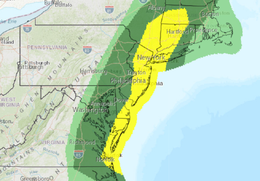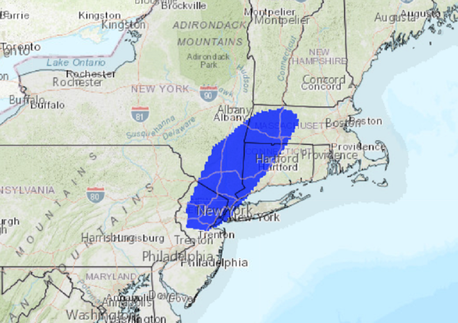
A potent frontal passage will trigger a line of thunderstorms in portions of the New England and the Mid Atlantic areas today, bringing the threat of damaging winds and the risk of isolated tornadoes. The worst of the damaging winds should occur between 1 and 6pm today. The National Weather Service’s Storm Prediction Center (SPC) is monitoring the situation, prepared to issue storm watches or warnings with local National Weather Service offices if/as needed.
A surface cyclone over south-central Pennsylvania will deepen as it tracks towards southwest Maine . An attendant cold front will sweep east and reach the Mid-Atlantic Coastal Plain midday to early afternoon. As it helps to destabilize the air mass, scattered to broken low-topped convective development is anticipated. Given the amplifying wave, the strengthening of low to mid-level southwesterlies should produce a short-lived area of strong storms known as a Quasi-Linear Convective System or QLCS for short, as it spreads into southern New England. More broken cells should be maintained farther south where a few transient supercells are expected. The atmospheric dynamics in this set-up support strong to isolated severe wind gusts with scattered damaging winds as the primary hazard. Farther south, marginally severe hail is possible where storm mode can remain semi-discrete before convection quickly spreads off the coast.

In addition to the threats from wind and hail, an elevated risk of a few tornadoes is also possible today. According to the SPC, the greatest threat of tornadoes will be over northern New Jersey, the New York City metro area, southeastern Upstate New York, western Connecticut, and western Massachusetts. While a widespread tornado outbreak is not expected, an isolated few tornadoes cannot be ruled out. While a risk exists for tornadoes, there are much better odds of severe wind gusts and straight-line wind damage from today’s storms.

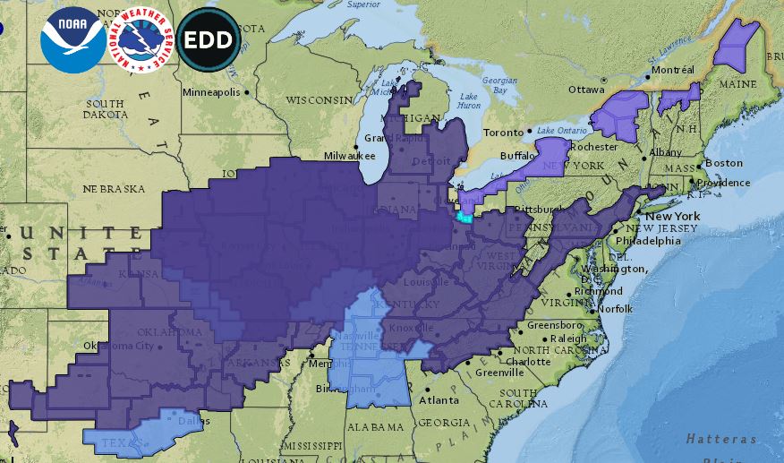
The cold front will help turn rain to snow over portions of New England; it will also help usher in significantly colder air across a large part of the country. Due to the threat of frost and freeze conditions in areas that may have had a jump start on spring agriculture, the National Weather Service has issued many Frost and Freeze related advisories. With accumulating snow expected over portions of New Englands and the Great Lakes region, advisories have been issued for that as well.