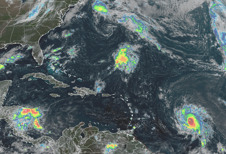
Hurricane Sam has now intensified into Major Hurricane Sam, with a period of rapid intensification bringing it to a Category 3 status on the Saffir-Simpson hurricane wind scale in a relatively short period of time. The Atlantic hurricane is forecast to get even stronger yet by the meteorologists at the National Hurricane Center in Miami, Florida. Sam is now the 4th major hurricane of the 2021 Atlantic Hurricane Season. Only 7 other years in the satellite era (from 1966 and beyond) have had 4+ major hurricanes by this date: 1969, 1996, 1999, 2004, 2005, 2010 and 2017.
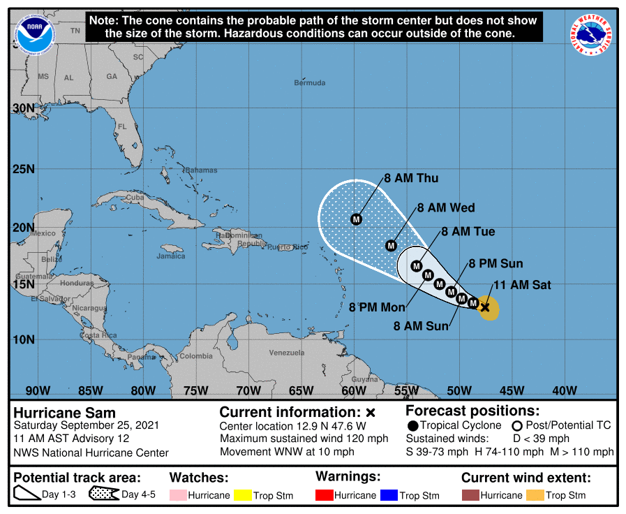
As of the latest advisory, Sam was located roughly 1,095 miles east-southeast of the Northern Leeward Islands. Maximum sustained winds are 120 mph with higher gusts while the pressure has dropped down to 960 mb or 28.35″. The storm is moving to the west-northwest at 10 mph.
The National Hurricane Center is forecast additional strengthening over the next day or so, with Sam becoming a potentially catastrophic category 4 storm by tomorrow. Beyond that, some minor fluctuations in strength are expected over the next five days as Sam spins about over open water. While the storm is moving to the west-northwest now at 10 mph, it is expected to slow down a bit this weekend; it should also turn more to the northwest by Monday.
While Hurricane Sam is powerful, it is rather small. Tropical storm force winds extend out 105 miles from the center; the powerful hurricane force winds only extend about 25 miles out from the center.
Sam is not expected to interact with any land for at least the next five days; because of that, no watches or warnings have been issued. However, dangerous swells generated by Sam are forecast to reach the Lesser Antilles early next week. These swells could cause life-threatening surf and rip current conditions.

The official 5-day forecast from the National Hurricane Center shows Major Hurricane Sam passing to the north of the Leeward Islands by Thursday. Doubts remain where the system will head beyond that. It appears an extremely complex weather pattern will set-up along the East Coast beyond five days; such a pattern could help either draw the storm in closer to the coast or help deflect it out to sea. The same weather pattern could also help develop other tropical or subtropical cyclones just east of the U.S. East Coast, which could also work in tandem with Sam to steer the storm to or away from the coast. With uncertainty in the extended range, people along the entire U.S. East Coast, the Bahamas, and Bermuda should make sure they have a Hurricane Action Plan and know what to do if it should become necessary to act on it. Such a situation could exist in early October as Sam travels north and west closer to land.