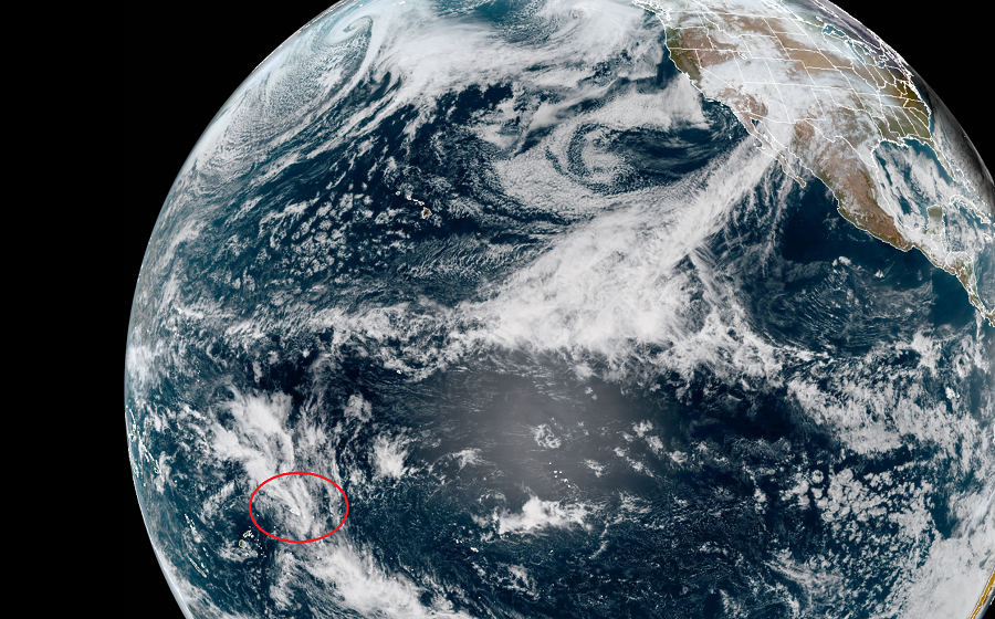
Just after Tropical Cyclone Vicki blew through the islands, American Samoa is now dealing with Tropical Cyclone Wasi. The American Samoa is an unincorporated territory of the United States located in the South Pacific Ocean, southeast of the independent nation of Samoa. American Samoa consists of five main islands and two coral atolls. The largest and most populous island is Tutuila, with the Manuʻa Islands, Rose Atoll, and Swains Island also included in the territory. All islands except for Swains Island are part of the Samoan Islands, located west of the Cook Islands, north of Tonga, and some 300 miles south of Tokelau. Due to Wasi, a Tropical Storm Warning remains in effect for Tutuila, Aunuu and Manua.
In the latest advisory from the National Weather Service office on Pago Pago, the center of Tropical Cyclone Wasi was estimated to be near 14.6S 172.6W, located south of Savaii, or about 110 miles west- northwest of Pago Pago. Maximum sustained winds have decreased to near 45 mph, with higher gusts. Even though Wasi has become disorganized overnight, the National Weather Service says the environment is still favorable for development as the tropical storm moves south of the territory. For now, Wasi is currently moving toward the southeast at about 10 mph. This general motion is expected to continue throughout the morning, with a turn toward the south this afternoon. As the center of the system moves further south-southeast, heavy rainbands and possible thunderstorms associated with Wasi are expected to increase in coverage over the next couple of hours as the monsoon surges over the region once again.
The American Samoa Emergency Management official is advising residents to remain on alert and secure loose items as necessary. “Be ready to comply with any orders that are issued by local emergency management officials. Continue to monitor radio for further warnings and advisories,” they advise in the latest bulletin. Heavy rainfall and runoff may cause small streams to overflow, resulting in flooding of low lying areas and roadways. Mud and landslides are also possible along steep slopes and mountainous areas as grounds become saturated. The public is advised to take necessary precautions when driving due to hazardous driving conditions and flooded roadways.
The National Weather Service in Pago Pago is located in Tafuna. Pago Pago experienced 40mph sustained winds and gusts to 75mph when Tropical Cyclone Vicki blew through earlier, creating widespread power outages there. The National Weather Service office in Honolulu, Hawaii provided back-up support for American Somoa. Typically the National Hurricane Center in Miami, Florida and the Central Pacific Hurricane Center in Honolulu, Hawaii serve as support for each other, but the unique weather situation unfolding with the tropical cyclones around American Samoa prompted the Honolulu office to step-in and provide assistance.
NOAA’s Central Pacific Hurricane Center (CPHC) Director, Chris Brenchley, described to us today how his Honolulu team coordinates, collaborates, & even swaps staff with Miami-based National Hurricane Center (NHC) to keep America #HurricaneStrong?@NWSHonolulu pic.twitter.com/W1WM2EeXeC
— the Weatherboy (@theWeatherboy) May 23, 2019