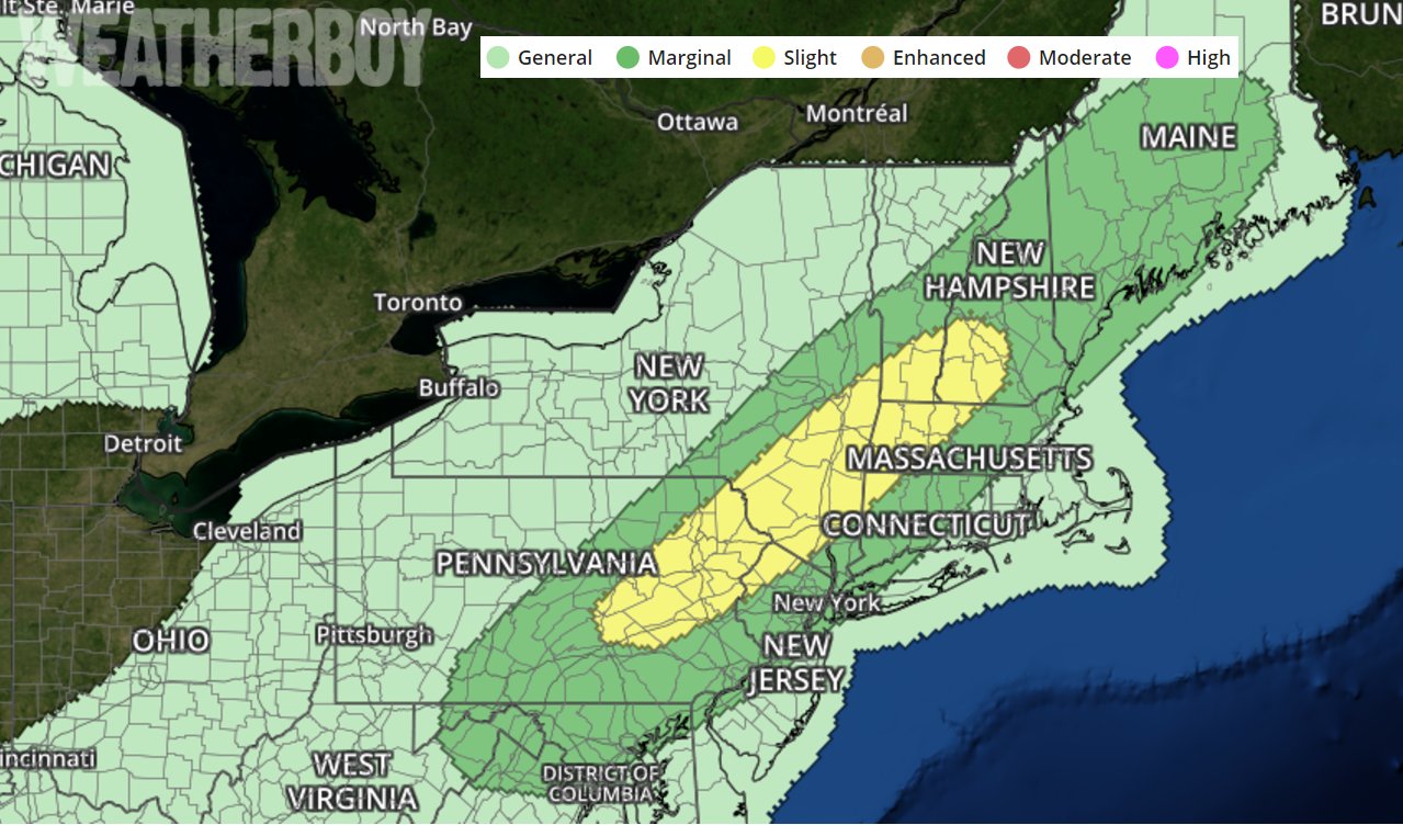
While the calendar says it’s September and all eyes are on Major Hurricane Irma, there could also be a severe weather outbreak in the northeast on Tuesday. Severe thunderstorms are possible Tuesday afternoon across portions of the Northeast, with the greatest threat over northeastern Pennsylvania, northern New Jersey, upstate New York, and west central New England.
A large-scale mid- to upper-level trough will amplify over the eastern continental United States and Tenessee Valley region; a surface low over northern Quebec will move to the northeast while an extensive cold front moves east-southeast across the Northeast and Mid-Atlantic states. The western portion of the front will push through portions of the lower Mississippi Valley and through a large part of the southern Great Plains.
Showers and thunderstorms near the Great Lakes tonight will mostly dissipate by early Tuesday morning . Despite some cloud debris restricting surface heating, pockets of stronger destabilization due partially to increased low-level moisture will contribute to weak to moderate buoyancy by early afternoon from western New England through the Hudson Valley and into the central Appalachians. This buoyancy will lead to thunderstorms during the PM hours, some of which could be severe. Although marginally severe hail is possible with cellular activity over Ohio, West Virginia, Virginia, and Delaware, bands of thunderstorms will be capable of 45-65 mph gusts and isolated to scattered pockets of wind damage with the stronger downdrafts. As the storms march to the coast, they will likely weaken.
As storms fire up, the National Weather Service may issue Severe Thunderstorm Watches or Warnings. People in watch and warning areas should take quick action to get to a place of safety until the storms pass.
While hail and damaging winds are possible, no significant risk of tornadoes exists in these storms at this time.
