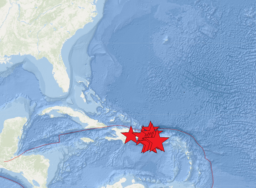
A series of moderate earthquakes continue to rock portions of the Caribbean near Puerto Rico and the Dominican Republic. While shaking is being felt throughout the region, the Tsunami Warning Center says there is no risk of tsunami to Puerto Rico and the U.S. Virgin Islands, the broader Caribbean, nor the U.S. East Coast at this time.
The strongest of the bunch, a 4.7, struck this morning about 160 miles west of Isla Mona at 8:15am local time. In a Tsunami Information Statement, the National Weather Service Tsunami Warning Center based on Ewa Beach, Hawaii, wrote, “Based on all available data, there is no threat to Puerto Rico, the U.S. Virgin Islands, or the British Virgin Islands from this Earthquake. People may have experienced shaking from the earthquake.”
9 other earthquakes occured in this region today, including a 3.8 near Punta Cana, Dominican Republic, and a 3.4 northwest of San Antonio, Puerto Rico.
Most of today’s earthquakes struck along the south coast of Puerto Rico where a strong earthquake hit in 2020. These earthquakes are likely continued aftershocks from that strong earthquake that struck the island in January 2020. That 6.4 created extensive damage in Puerto Rico, including widespread power failures across much of the island. An earthquake swarm started here in December 2019 and unrest has continued since.
These earthquakes are occurring near the northern edge of the Caribbean Plate, a mostly oceanic tectonic plate underlying Central America and the Caribbean Sea off of the north coast of South America. The Caribbean Plate borders the North American Plate, the South American Plate, the Nazca Plate, and the Cocos Plate. The borders of these plates are home to ongoing seismic activity, including frequent earthquakes, occasional tsunamis, and sometimes even volcanic eruptions.
