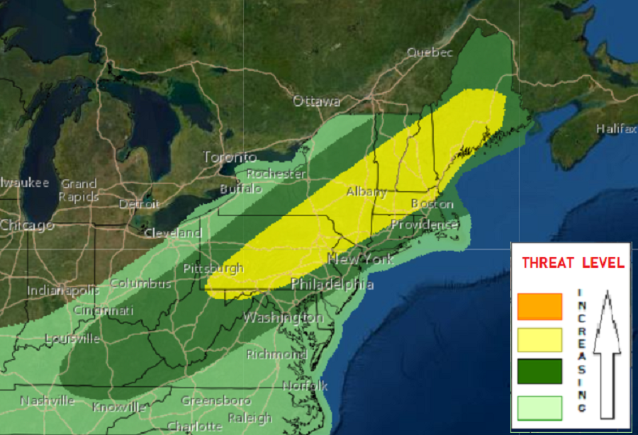
The threat of more severe thunderstorms and the risk of isolated tornadoes returns in the northeast today, with growing risk during the PM hours. According to the National Weather Service’s Storm Prediction Center (SPC), severe thunderstorms capable of damaging winds, severe hail and an isolated tornado threat are expected across the northeast states and New England.
A trough moving through the northeast and southeastern Canada is responsible for today’s latest severe weather outbreak. According to the SPC, height falls will increase into the afternoon as an eastward-moving upper trough over northern portions of Ontario and Quebec influences the region. Southwest winds through a deep layer will steadily increase during the day, setting the stable for plenty of destabilization in the atmosphere. The greatest destabilization will be near and ahead of the front from eastern Pennsylvania and New Jersey into southern New York and points north and east into southern New England.

Due to this unstable airmass, storms are expected to develop during the PM hours and steadily increase near the front. The SPC says wind profiles will be supportive of initial supercells, while also supporting the evolution of northeastward-moving bands and bowing segments. “Damaging winds will likely be the most common hazard, although modestly steep mid-level lapse rates and long/semi-straight hodographs through the cloud-bearing layer will also support the potential for severe hail, particularly with the more discrete storms,” the SPC warns.
Although the expected low-level flow may tend to veer over time, ample low-level hodograph length could yield some tornado risk as well, particularly across southeast New York into New England. The greatest threat of tornadoes is in the Albany capital district in upstate New York, the southern third of Vermont, the southern half of New Hampshire, and southern Maine.
Some thunderstorms could also dump copious amounts of rain in a short period of time, leading to flash flood issues. The National Weather Service warns: “Turn around, don’t drown; never drive through flood waters.”
