While an active weather pattern in recent weeks has spawned numerous Tornado Warnings across the northeast, with several confirmed touch-downs, it appears more rough weather is making a return with scattered severe thunderstorms and isolated tornadoes possible today over portions of New Jersey, Pennsylvania, New York, and the broader Northeast and Mid Atlantic regions.
According to the National Weather Service’s Storm Prediction Center (SPC), scattered severe thunderstorms are expected to develop across northern Montana later today and spread east along the international border into North Dakota. Large hail and potentially very strong winds are expected with this activity. A few severe storms may also spread southeast from western Ontario into the upper Great Lakes. Elsewhere, gusty winds and perhaps a tornado or two are possible across the middle Atlantic into southern New England.
The SPC says conditions could be ripe for severe storms. “Forecast soundings suggest ample deep-layer flow/shear for organized, potentially rotating updrafts,” caution the SPC in the latest Convective Outlook report. “While a few supercells may ultimately evolve within a broader zone of convection, poor lapse rates may ultimately limit more robust updrafts.”
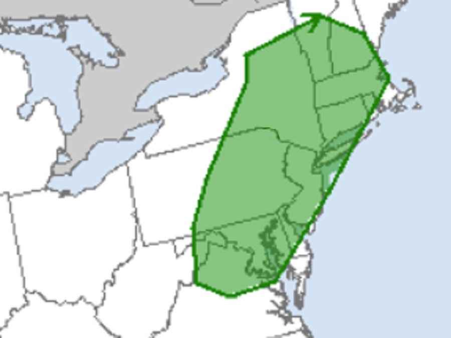
While thunderstorms are possible across much of the Mid Atlantic and northeast today, the best odds for tornadic cells to form will be over northern Virginia, much of Maryland away from the coast, the northern two-thirds of Delaware, the eastern half of Pennsylvania, all of New Jersey except for Cape May County, most of New York including Long Island and New York City, all of Connecticut, much of Rhode Island and Massachusetts, and southern portions of Vermont and New Hampshire.
While there is an elevated risk of tornadoes, not everyone will see one. It’s also possible not everyone will see a thunderstorm; today’s activity will be very scattered in nature. Storms will move from west to east during the day; by 11 pm, the severe weather threat should be wrapped up across the northeast.
