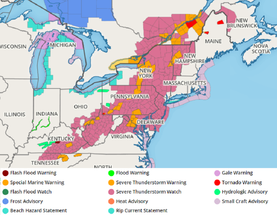
Severe thunderstorms and even isolated tornadoes are breaking out across the northeast, forcing the National Weather Service’s Storm Prediction Center (SPC) to issue a very large area a Severe Thunderstorm Watch. The Severe Thunderstorm Watch is in effect from north central Tennessee across most of Kentucky, Pennsylvania, New York, West Virginia, New Jersey, and Maryland, southeastern Ohio, northern New Hampshire, western Connecticut, northern Virginia, and all of New Hampshire and Delaware. While there are more than a dozen active Severe Thunderstorm Warnings in effect within this watch area, there is also an active Tornado Warning just outside of it in northern Maine.
Scattered severe thunderstorms are expected from the upper Ohio Valley and Mid-Atlantic into northern New England, capable of damaging gusts, sporadic severe hail, and perhaps a couple of tornadoes according to the SPC. It appears thunderstorms are firing up along a front this afternoon in the northeast, with some isolated cells also forming in the free warm sector to its east. The SPC says vertical shear will be sufficient for a mix of multicell and occasional supercell structures, capable of damaging winds and large hail. While the low level shear is strongest over Quebec, Canada, the SPC says it may be sufficient over parts of Vermont and New York for an isolated tornado or two as well.
This severe weather activity will sweep east throughout the later afternoon and evening hours today. Storms will weaken as they approach cooler marine-influenced air mass over far eastern New England and coastal New Jersey.
The National Weather Service cautions people: “when thunder roars, head indoors.” When thunder is close enough to be heard, it usually means lightning is close enough to kill. On average, 41 people die from lightning strikes every year. While there are threats of damaging wind and hail, along with an isolated tornado threat, people should understand the risk that lightning also poses in these storms.