Just a day after severe thunderstorms unleashed wind damage across portions of eastern Pennsylvania and New Jersey, another round of severe storms are plowing their way through the northeast with fresh wind and hail threats. An isolated tornado or two are possible too. Due to those threats, the National Weather Service has issued two large Severe Thunderstorm Watches for the region with multiple Severe Thunderstorm Warnings issued within each watch box.
A strong cold front will cross the Middle Atlantic region tonight, setting the stage for today’s severe weather outbreak. The frontal passage will be followed by high pressure for the end of the week and into the weekend, bringing more fair conditions, but until then, severe storms will continue to blossom into the PM hours.
Convection is ongoing across eastern Pennsylvania and into northwestern New Jersey. Damaging winds have already been reported with some of these severe thunderstorms with more expected on the way. According to the National Weather Service, atmospheric ingredients are providing ample fuel for convection to erupt across the region through the rest of today and into tonight. Sufficient deep layer shear and steep lapse rates will also support rapidly developing updrafts and severe storms. An abundance of atmospheric moisture may also translate into heavy downpours leading to localized flash flooding.
The first round of storms will mainly impact the I-95 corridor and points north and west through this evening before the front shifts east-southeast and brings another round of numerous to widespread storms across southern NJ and the Delmarva through late tonight.
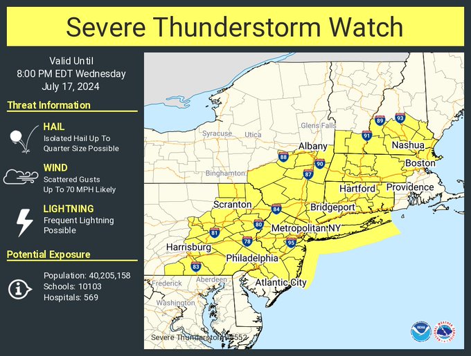
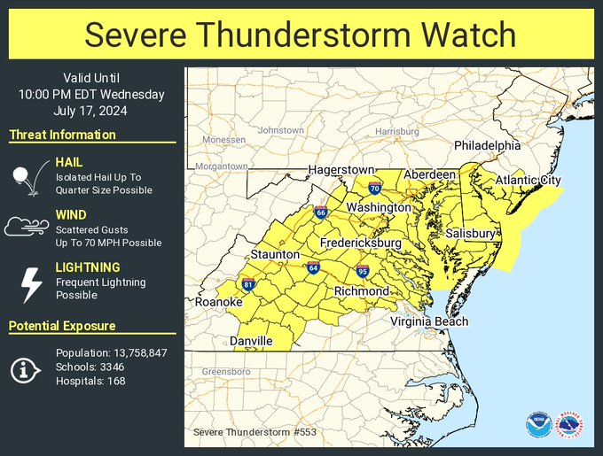
Two large Severe Thunderstorm Watches have been issued as a result of today’s outbreak. The first is in effect through 8pm and includes southern Vermont and New Hampshire, most of Massachusetts, southeastern New York, all of Connecticut, most of New Jersey, and eastern Pennsylvania. The second, in effect until 10pm, includes the rest of New Jersey, all of Delaware, most of Maryland, and a large part of Virginia.
Storms should eventually give way to just some residual showers before tapering off from northwest to southeast overnight as the cold front shifts further offshore. After frontal passage, temperatures and humidity levels should be knocked down to some more tolerable readings.
