After 2-day break from a 3-day severe weather outbreak, it appears more rough weather will be returning to portions of the Mid Atlantic and Northeast tomorrow.
A variety of meteorological factors will conspire together to produce a bout of severe weather. A longwave upper trough will deepen over the Northeast and Mid Atlantic on Sunday, as individual vorticity maxima rotate through the mean trough position. A surface low should deepen and move northeastward across southern Quebec during the afternoon, as a trailing cold front sweeps through the Northeast/Mid Atlantic during the afternoon and evening. While cloud cover from weakening overnight convection may tend to limit insolation over portions of the area, sufficient heating and low-level moisture should result in the development of moderate buoyancy in advance of the cold front by afternoon. Effective shear will support some organized structures; linear modes are most likely given that the primary focusing mechanism will be along the cold front, though any pre-frontal development will have some supercell potential.
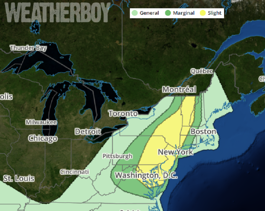
In short, according to the National Weather Service’s Storm Prediction Center, damaging wind will likely be the primary threat, though any discrete storms will also have some potential for hail and perhaps a tornado. The greatest risk area for severe weather will be over New Jersey and Delaware, eastern Maryland, Pennsylvania, and New York, northeastern Virginia, western Connecticut, Massachusetts, and New Hampshire, and much of Vermont. Due to the threats, the National Weather Service could issue Severe Thunderstorm Watches tomorrow. If a tornado is observed on RADAR or by a trained spotter in one of these cells, a Tornado Warning may also be issued.
A Severe Thunderstorm Watch means conditions are favorable for severe thunderstorms in and close to the watch area. Persons in these areas should be on the lookout for threatening weather conditions and listen for later statements and possible warnings. Severe thunderstorms can and occasionally do produce tornadoes.
If a Tornado Warning is issued:
- Go to the basement or take shelter in a small interior ground floor room such as a bathroom, closet or hallway.
- If you have no basement, protect yourself by taking shelter under a heavy table or desk.
- In all cases, stay away from windows, outside walls and doors.
High pressure will build into this region tonight, bringing the multi-day severe weather event to an end. Friday will feature fair and dry conditions and comfortable temperatures with the high pressure in place.
