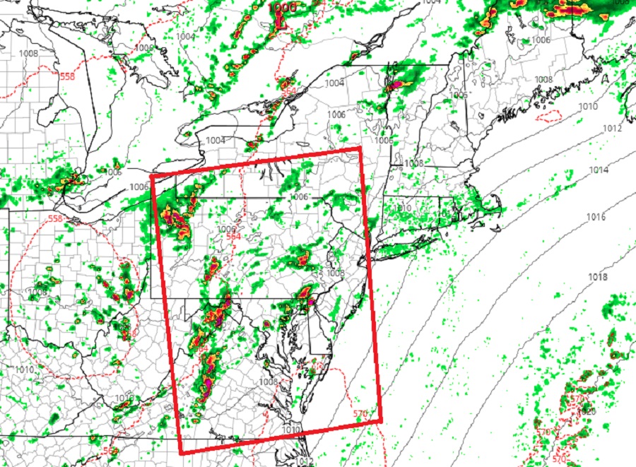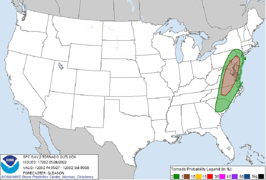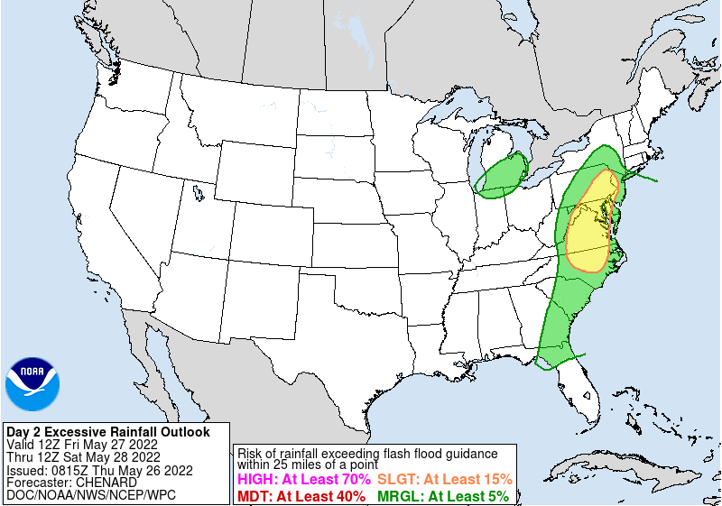
The National Weather Service is warning about a fresh round of severe thunderstorms for the Mid Atlantic on Friday afternoon, with risks of tornadoes and flash flooding. The National Weather Service’s Storm Prediction Center (SPC) has outlined an area along the U.S. East Coast at risk of severe thunderstorms stretching from northeastern Pennsylvania and New Jersey south to southern South Carolina. Within this severe weather threat area, they’ve identified an area from southeastern Pennsylvania and western New Jersey south to central North Carolina at a heightened risk of tornadic cells from those expected severe weather cells. In addition to the severe weather threat, the National Weather Service’s Weather Prediction Center (WPC) believes there’s a risk of excessive rain and flood threats from these heavier showers and storms in an area stretching from eastern Pennsylvania and western New Jersey south into central North Carolina. In most parts, the threat of tornadic cells is overlapped by the threat of flooding rains.

A few key ingredients in the atmosphere will come together to set the stage for Friday’s expected severe weather outbreak. According to the SPC, a mid/upper-level low will progress eastward from the Ohio Valley across the Mid-Atlantic and Northeast on Friday. At the surface, an elongated area of low pressure extending from the Great Lakes into Quebec should develop slowly east-northeastward through the period in tandem with the upper low, while a cold front will move eastward over much of the East Coast. “Deep-layer shear of 35-50+ kt will easily support thunderstorm organization, with a mix of multi-cells and supercells possible,” said the SPC in their latest Convective Outlook.
Based on that Convective Outlook, it appears thunderstorms that will be ongoing during Friday morning should gradually increase in coverage and intensity along and ahead of the front from late Friday morning through the afternoon. With a large southerly component to the low/mid level winds, convection should tend to grow upscale with time into small bowing clusters as individual updrafts interact with each other.
With Friday’s severe weather outbreak, it appears that scattered damaging winds will probably be the main threat as thunderstorms spread east-northeastward through the afternoon and early evening given the messy and mainly multicellular mode. However, the SPC says that conditions will also support a risk for a few tornadoes with any embedded supercells, particularly from central North Carolina into Virginia, Maryland, Delaware, southeastern Pennsylvania, and New Jersey Friday afternoon. Beyond wind and tornado threats, the SPC says isolated hail may also occur with the strongest updrafts.

In addition to the severe nature of the cells, there could be especially heavy rain coming from the storms which could create localized flooding threats. Ahead of the slow moving closed mid and upper low and a surface boundary advancing eastward during the day, warm and very moist air is forecast to surge north up the east coast, bringing precipitable water values of 1.5-1.75″ with it. According to the WPC, this is near 2 standard deviations above normal for portions of the Mid Atlantic, suggesting the threat of isolated flooding concerns. “There is also the potential for more than one round of storms as the better forcing looks to lag the initial convective round,” says the WPC, suggesting that areas seeing heavy rain from earlier storm cells could see a repeat just hours laters. The potential exists for hourly totals of 1-2″ at times during the afternoon hours.
“Hydrologic conditions have started to recover back closer to normal after a wet period…but nonetheless neutral to slightly above average soil saturation/streamflows should still exist over portions of the area on Friday morning,” the WPC said in their latest Excessive Rainfall Discussion.
As such, beyond keeping alert for tornadic cells, the National Weather Service also wants people to be aware of the possibility of flooding and flash flooding from some of those heavier downpours on Friday.
The severe shower and storm activity should diminish as the sun sets tomorrow. However, clouds and showers will linger into the first half of the weekend as the system is slow to exit the coast.