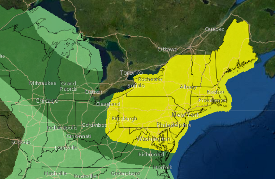
While the Gulf Coast region is dealing with the wrath of Hurricanes Marco and Laura, the northeastern United States will also be dealing with a bout of severe weather. In the latest Convective Outlook from the National Weather Service’s Storm Prediction Center (SPC), much of the northeast is in a danger area where severe thunderstorm activity is expected to develop on Tuesday.
A strong cold front is forecast to shift across the U.S./Canada border and into New England early this week; it’ll quickly advance towards the coast, while sagging more slowly southward across the central Appalachians and Mid Atlantic region. The National Weather Service is exploring just how destabilized the atmosphere could become ahead of this fast moving weather boundary; they will refine the risk and threat areas on Monday ahead of Tuesday’s severe weather event. However, with very strong flow aloft promoting rapid storm motions, the SPC says the risk for damaging winds will exist with any sustained convection in the region.
If more destabilization than currently expected occurs ahead of the front, especially if the frontal progression is slower in future forecasts, there would be an even greater severe weather probability across the region.
Farther south, greater destabilization is expected ahead of the sagging front, but flow aloft will progressively weaken with southward extent. Still, atmospheric ingredients should be able to support thunderstorms with damaging winds and large hail across the central Appalachians and into the Mid Atlantic during the late afternoon and evening hours on Tuesday.
While the national focus will be on Hurricanes Marco and Laura and their impacts across the Gulf Coast, it is important to point out that severe weather events like this can also occur concurrently elsewhere in the continental United States.
