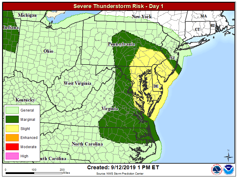
Severe weather is expected in portions of the Mid Atlantic today, with the greatest risk of severe storms over southeastern Pennsylvania, southern New Jersey, Delaware, eastern Maryland, and northeastern Virginia. The cities of Washington, DC, Baltimore, MD, Philadelphia, PA, Newark, DE, and Atlantic CIty, NJ are included in the risk area.
Meteorologists are tracking an atmospheric disturbance that is expected to trigger severe weather in this region. The southern fringe of stronger west-northwesterly flow aloft has sagged into this region today, where weak mid-level height falls are forecast this afternoon. Visible satellite shows mostly clear skies, allowing temperatures to warm through the 80s and lower 90s in a very moist regime. Afternoon forecast guidance agrees on the development of scattered thunderstorms over southeast Pennsylvania and southern New Jersey, building southward through the late afternoon into Delaware, eastern Maryland, and coastal Virginia. Forecast soundings are indicative of an environment that promotes faster storm motions and greater potential for momentum transfer of strong, damaging winds to the surface in stronger storm clusters.
Strict criteria is followed in determining what a severe thunderstorm is. A severe thunderstorm by definition is a thunderstorm that produces one inch hail or larger in diameter and/or has winds equal or exceed 58 miles an hour. Severe thunderstorms can also spawn tornadoes.
In the Mid Atlantic today, the primary threat is wind; there’s little to no risk of hail and tornado formation at this time.
The time most likely to see severe thunderstorms form is between 3pm and 9pm today.
