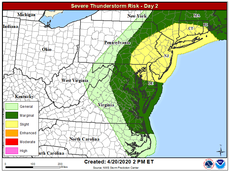
As a strong cold front pushes east, an outbreak of severe weather is likely for portions of eastern Pennsylvania, all of New Jersey, northern Delaware, northeastern Maryland, much of Connecticut, southern Rhode Island, and southeastern New York including all of New York City and Long Island.
An area of low pressure will track south of the Mid Atlantic today. A strong cold front will move through on Tuesday, followed by high pressure on Wednesday. While severe thunderstorms could generate an isolated tornado or two, Tuesday’s threat should primarily be from damaging wind gusts. Some gusty thunderstorms may have winds over 50 mph during the afternoon and early evening hours.
While many typically depend on weather RADAR to track severe storms moving through this area, it won’t be completely possible tomorrow. The National Weather Service is in the process of upgrading a weather RADAR site in New Jersey, forcing meteorologists to observe conditions on adjacent RADARs as storms move into this new blindspot.
With many sheltering in place due to the COVID-19 Pandemic, severe weather action plans may be different than they usually are. Places that are safe shelters for the pandemic may not be safe for severe thunderstorms; people should judge how stable their structure is before severe weather arrives and take action to stay safe from both the pandemic threat and the tornado threat. Due to the pandemic, it may also take time for first responders and utility crews to report to and recover at disaster scenes.