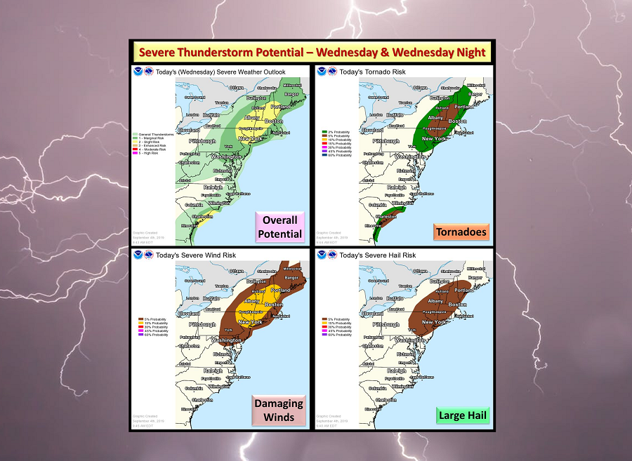
A severe weather event tied to the weather system helping steer Dorian north away from the Bahamas is likely to impact portions of the northeast later today and tonight.
A variety of ingredients in the atmosphere are coming together to trigger this severe weather event. A shortwave trough from southwest Quebec to the Lower Great Lakes will progress east with trailing portion shifting across New England this evening. A surface cold front tied to this shortwave trough will reach the Champlain and Hudson Valleys by afternoon with trailing portion arcing southwest across the central Appalachians. Ongoing convection within the warm conveyor just ahead of the front should persist east, with additional development expected in its immediate wake along the front by midday.
This type of atmospheric setup should favor multiple clusters line segments of thunderstorms with embedded supercell structures, most likely from eastern Pennsylvania and New Jersey into southwest Maine. According to the National Weather Service’s Storm Prediction Center, damaging winds will probably be the main threat given the strength of the low/mid-level flow, but isolated marginally severe hail could also occur. A couple tornadoes are possible, centered on a corridor from southeast New York to New Hampshire.
The threat of severe weather from this system will diminish late tonight. However, the northern fringes of Dorian will begin to move north towards the Canadian Maritimes for the balance of the week, brushing the east coast with rough surf and the threat of rain and wind.