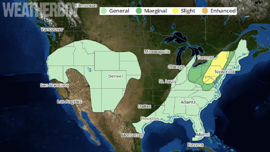
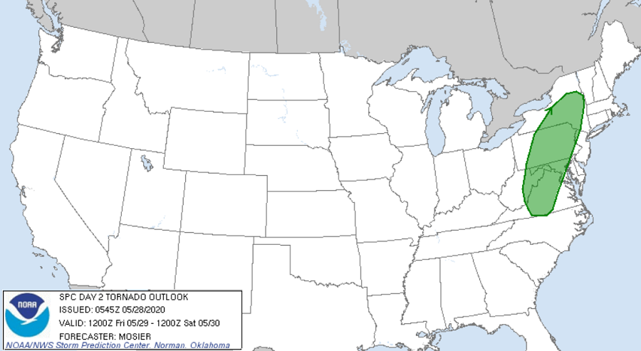
A severe weather outbreak is likely for portions of the northeast tomorrow; there’s also an elevated risk of tornadoes for portions of New York, New Jersey, Pennsylvania, Maryland, West Virginia, and Virginia.
A robust weather system will be pushing through the northeast on Friday, setting the stage for a severe weather show-down. According to the National Weather Service’s Storm Prediction Center, a shortwave trough and attendant vorticity maximum are forecast to move from the middle Ohio Valley northeastward into western portions of the Northeast states on Friday. Another shortwave will move through the Upper Great Lakes, in close proximity to the lead wave. With high dewpoints and relative humidity readings expected from the Mid Atlantic north into Upstate New York, the air mass is expected to destabilize under modest daytime heating ahead of the approaching shortwave troughs and associated cold front. The lead shortwave trough is expected to trigger thunderstorms in the warm sector over the Northeast and northern Mid-Atlantic, while the second shortwave trough and cold front will help develop thunderstorms over the middle and upper Ohio Valley.
In this severe weather area, multi-cell storms and numerous line segments of storms are anticipated. According to the Storm Prediction Center, vertical shear will be strong enough to support storm organization, resulting in the potential for damaging wind gusts within the more robust line segments. Some isolated hail is also possible, particularly with any more discrete storms.
Beyond the threat of damaging wind gusts and hail, there’s also a tornado threat stretching from Upstate New York south to south-central Virginia. According to the Storm Prediction Center, the tornado threat will depend largely on direction of the surface winds and strength of the low-level flow. A more southerly surface-wind direction combined with stronger low-level flow would contribute to greater low-level shear and higher tornado potential. While this threat is slight, people within the risk area should monitor evolving weather conditions and be ready to act quickly should a Severe Thunderstorm or Tornado Warning be issued for their area.
