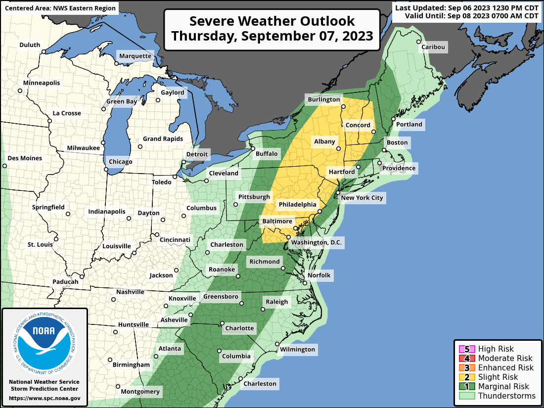
According to the National Weather Service’s Storm Prediction Center, a severe weather outbreak is possible in portions of the northeast on Thursday. Unlike earlier outbreaks this summer that produced a tornado threat, Thursday’s main weather hazard will be the possibility of significant, damaging straight-line winds. The best chance of dangerous storms will be during the PM hours. The area at greatest risk of severe storms is over western Maryland, northern Delaware, eastern Pennsylvania, northern and western New Jersey, eastern New York, much of Vermont, western New Hampshire and Massachussetts, and northwestern Connecticut.
Showers and isolated thunderstorms are forecast to pop-up across the central Appalachians vicinity on Thursday morning ahead of a weak cold front moving eastward across the mountains and southeastward across the Southeast. As the warm sector heats and destabilizes through the day, additional, isolated storm development is expected along the entire extent of this front, from the lower Great Lakes and New England, to the Gulf Coast.
According to the Storm Prediction Center, somewhat more concentrated convective development is expected to evolve from the Mid-Atlantic States into New England, associated with a compact vorticity maximum expected to shift northeastward across the area during the afternoon and evening, in advance of the main short-wave trough to the west. Slightly stronger flow aloft and moderate instability may result in bands and clusters of storms capable of producing locally damaging winds, and marginally severe hail. The Storm Prediction Center says that the activity should peak in intensity through the late afternoon hours and early evening, before diminishing at night.
