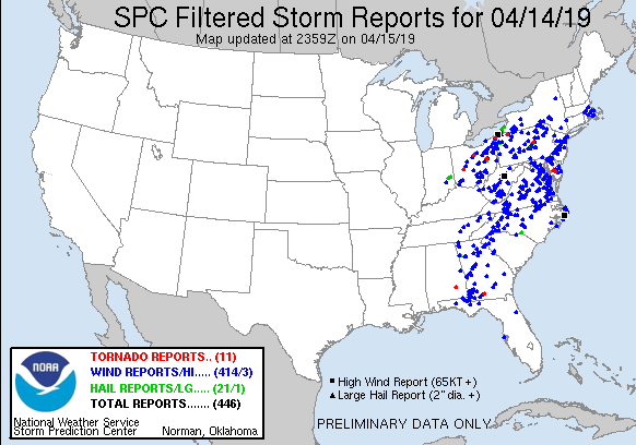
An intense area of thunderstorms which included some tornadoes broke a record for the year: the April 14-15 outbreak generated more than 446 reports of large hail, damaging winds, and tornadoes, which makes it the busiest severe weather day on record so far this year. It also marks the busiest severe weather day since March 14, which had 237 severe weather reports, according to the National Weather Service Storm Prediction Center (NWSSPC.

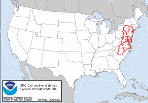
The night of April 14 to the morning of April 15 was also very busy for the NWSSPC; a large piece of the US. At 1am ET, 6 Tornado Watch boxes were in effect from upstate New York south to North Carolina, including the cities of New York, Philadelphia, Washington, DC, Baltimore, and Charlotte. A Tornado Warning was also in effect for Philadelphia for a portion of the watch time.
The National Weather Service office in Mount Holly, NJ confirmed that a strong tornado touched down in Delaware from this outbreak. The EF2 tornado touched down at 3:38am in Sussex County, Delaware, starting at Laurel and continuing to Seaford. The tornado had maximum sustained winds of 120mph. The tornado had a path width of 50 yards and traveled along a path that was 6.2 miles long. According to the National Weather Service, one barn was destroyed while a tree fell on a house, resulting in one injury. In addition, there was roof damage to several other homes and barns. Many trees were uprooted along the tornado path, and a few were snapped.
The middle-of-the-night severe weather outbreak triggered numerous tornado warnings in the Mid Atlantic after 2am. The late night nature of the severe weather outbreak led to many memes, including this one posted by Weatherboy Weather on Facebook which was shared more than 12,000 times by more than 1 million people that viewed it.