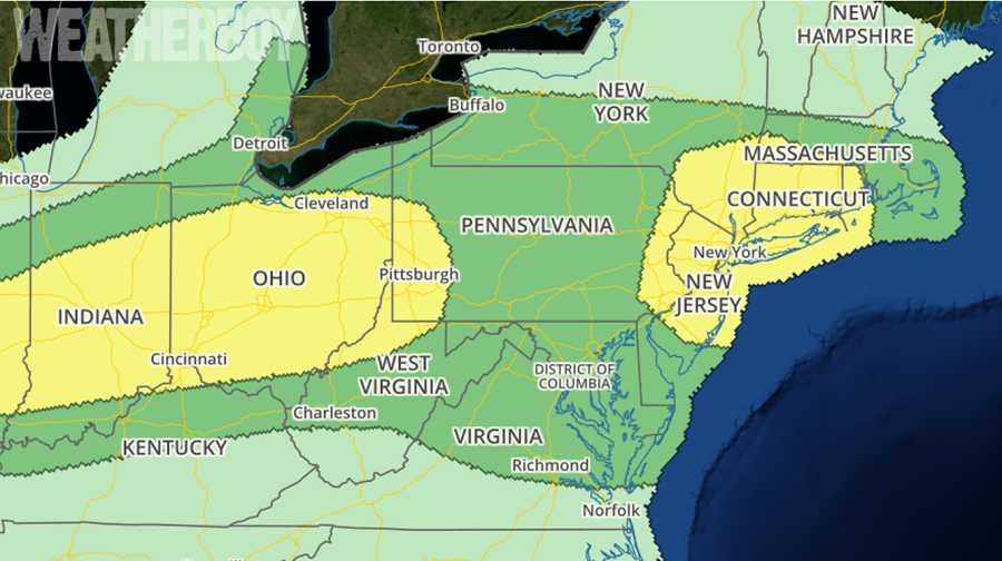
In addition to dangerous heat and humidity levels, the National Weather Service is also tracking the possibility of severe weather today in the NYC metro area. Some isolated severe thunderstorms are expected today across the Ohio Valley into the Northeastern states, with the greatest threat anchored over New Jersey, the New York City metro area, Long Island, and Connecticut. Another area is also possible across central and southern Illinois, Indiana, and much of Ohio.
In the Mid West and Ohio Valley area now, considerable cloud cover exists across the region, particularly in association with an eastward-moving convective cluster across parts of Ohio and Pennsylvania, with an additional corridor of scattered thunderstorms ongoing across northern Missouri into central Illinois A diminishing coverage of thunderstorms and thinning cloud cover should allow for areas of moderate destabilization this afternoon within a moist air mass ahead of a southeastward-moving front that will continue to move across parts of Illinois/Indiana into southern Lower Michigan and eventually Ohio. This should allow an increase and intensification of storms along the front, or perhaps more so, semi-focused along outflow and zones of differential heating. Some sustained multicells or clusters capable of wind damage should be the most common scenario, although a residual belt of somewhat stronger low/mid-tropospheric winds across Ohio into western Pennsylvania could allow for a few supercells later today.
Meanwhile, eyes are on the Big Apple where another disturbance could trigger severe storms later today. A convectively augmented mid-level disturbance across northern Ohio, and its enhanced belt of mid-level westerly winds will continue eastward today towards northern New Jersey.
While its related preceding cloud cover and convection is a bit faster eastward than most short-term computer guidance that meteorologists use to forecast the weather, the air mass should have sufficient time to moderately destabilize across parts of the coastal Northeast ahead of the upstream convection. Accordingly, thunderstorms should intensify this afternoon as the storm cluster-preceding air mass destabilizes, with moderately strong westerly flow aloft allowing for semi-organized bands/clusters of convection to move generally eastward across the
region. Damaging winds will be the primary severe risk. with this area of storms.
The threat of storms will diminish this evening, with a renewed batch of showers and storms forming on Friday as two cold fronts push through the humid air mass in the eastern US, providing some relief from today’s hot and humid conditions in the process.
