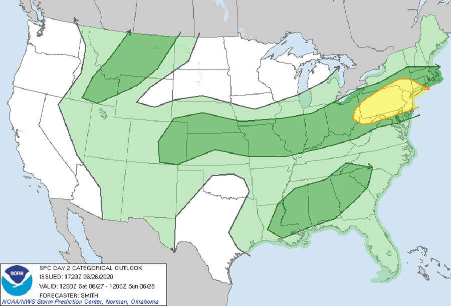
The weekend will kick-off with some severe weather, with the greatest threat of severe thunderstorms over portions of Ohio, Maryland, Pennsylvania, Delaware, New York, and New Jersey; there’s even an elevated threat of isolated tornadoes over New Jersey, northeastern Pennsylvania, and southeastern New York.
According to the National Weather Service’s Storm Prediction Center, a mid-level shortwave trough is forecast to move across parts of the Northeast during the day with a belt of stronger flow moving through the base of the trough. In the low levels, a very weak and ill-defined baroclinic zone is forecast to extend from the lower Great Lakes region west-southwestward across the Midwest and Ohio Valley states and then westward to the central High Plains. This will help set-up a situation moving today’s severe weather event near the Great Lakes to the Mid Atlantic tomorrow.
Scattered showers and thunderstorms are expected throughout the day on Saturday. Stronger clusters and bands of thunderstorms are forecast to develop by the early afternoon hours and move east into a destabilizing airmass over the Delaware River Valley. It is over eastern Pennsylvania, New Jersey, and perhaps as far north as the lower Hudson Valley that a greater concentration of strong to severe gusts of 50-70 mph may occur. This is also an area where there’s a risk of isolated tornadoes. Farther south over Maryland and Virginia, lower storm coverage is expected due to a weaker westerly flow. However, according to the Storm Prediction Center, ample heating and stronger storms possibly developing over the terrain and spreading east may pose a risk for wind damage during the mid-late
afternoon and early evening.
