Severe weather that has been impacting portions of the southern U.S. the last few days will shift to the Mid Atlantic tomorrow. Before the system responsible for the rough weather heads out to sea, strong to severe thunderstorms and the risk of tornadic cells will be present in the Mid Atlantic on Sunday.
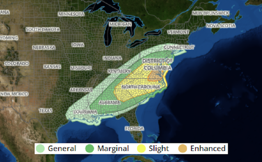
While strong to severe thunderstorms are possible from as far north as central Pennsylvania and northern New Jersey to as far south as southern Mississippi, Alabama, and Georgia, the greatest severe weather threat exists over northeastern North Carolina, eastern Virginia, northeastern Maryland, and southern Delaware.
According to the National Weather Service’s Storm Prediction Center (SPC), a potent upper-level shortwave trough will continue to intensify as it moves out of the Midwest and into the Mid-Atlantic and Northeast. A surface cyclone will deepen in Ontario/Quebec in southeastern Canada with an attendant cold front roughly along the Appalachian crest. This front will move quickly eastward and serve as the focus for strong to severe storms from the Mid-Atlantic into the Carolinas and portions of the Southeast.
Low-level flow ahead of the cold front is forecast to increase near the surface. This, along with the speed of the front, should favor strong to severe wind gusts, with some gusts in excess of 70 mph within the stronger storms. A relatively more favorable corridor for wind damage appears probable along the North Carolina / Virginia border into southeast Virginia. In addition to the threat of severe winds, the SPC says low-level hodographs are favorable for tornadoes, particularly if discrete storms can develop ahead of the front.
Farther north into the Mid-Atlantic, low-level wind fields will be stronger, but buoyancy will generally be less on account of decreased boundary-layer moisture and greater cloud cover limiting surface heating. However, atmospheric conditions will still favor severe, convectively augmented surface gusts. Should greater heating occur in pockets, the overall threat for damaging winds could increase. Tornadoes will also be possible, but low-level thermodynamics and storm-mode are more questionable to the north.
